Why Regional Weather Data Is Not Enough for Emergency Management
When an emergency manager makes a decision, that decision happens at a specific location. A shelter, a staging area, an event venue, a county road. But the weather data most agencies rely on comes from airport observation stations or NWS reporting points that may be 20, 30, or 50 miles away.
The gap between a regional forecast and actual conditions at your location is where people get hurt. A wind reading from an airport across the county does not tell you what is happening at your emergency operations center right now. A temperature reading from a monitoring station in the next parish does not tell you whether your field teams are working in dangerous heat conditions.
Real-time weather monitoring for emergency management means sensors at your specific locations, updating continuously, triggering alerts automatically. Not a forecast. Not an average. Actual current conditions where your operations are happening.
The 0.8-second difference
The industry standard for commercial weather services is a five-minute data refresh. Weatherstem updates every 0.8 seconds. In a rapidly developing severe weather event, that gap is operationally significant. An automated alert that fires on actual local conditions is fundamentally different from one triggered by data that is already five minutes old.
What Emergency Managers Need to Monitor
A complete weather monitoring deployment for emergency management covers the full range of hazards your jurisdiction faces. The specific parameters matter because each one drives different operational decisions.
Dual-feed detection using NLDN as the primary network and AccuWeather as a live backup. Automated clearance and return-to-activity protocols with full timestamped documentation.
Critical for wildfire spread modeling, hurricane operations, hazmat incident response, and outdoor event safety. Real-time directional data at your specific location.
Tipping bucket rain gauges track accumulation in real time for flood monitoring, drainage assessment, and storm event documentation for insurance and FEMA reporting.
Real-time ambient temperature, heat index, and WBGT for worker safety compliance during emergency operations in hot weather conditions and extended field deployments.
PM2.5 and AQI monitoring for wildfire smoke events, industrial incidents, and post-disaster air quality assessment. Critical for shelter-in-place and evacuation decisions.
Rapid pressure drops indicate approaching severe weather. Continuous monitoring provides early warning for developing storm systems before they reach your area.
NWS Alert Integration Included
Every Weatherstem station automatically ingests National Weather Service watches, warnings, and advisories and routes them through the same alert system as locally-detected conditions. Your team gets one unified alert stream covering both local sensor data and official NWS products.
Regional Weather Data vs a Local Station: What Emergency Managers Actually Get
Most emergency managers work with a combination of NWS products, regional forecast data, and airport observation stations. That is a sound baseline for broad situational awareness. But when operations require real decisions at specific locations, the gap between regional data and on-site data becomes consequential. Here is what that gap looks like in practice.
NWS products remain essential for forecasting, watches, and warnings at scale. A local monitoring network complements that data by providing ground-truth conditions at the locations where emergency operations actually occur. Weatherstem also shares station data with NWS regional offices to support their forecasting and analysis — the relationship runs both directions.
Case Study: Florida Division of Emergency Management
Building the Florida Severe Weather Mesonet
Florida Division of Emergency Management Director Kevin Guthrie discusses the Florida Severe Weather Mesonet on The Weather Channel.
Florida Severe Weather Mesonet
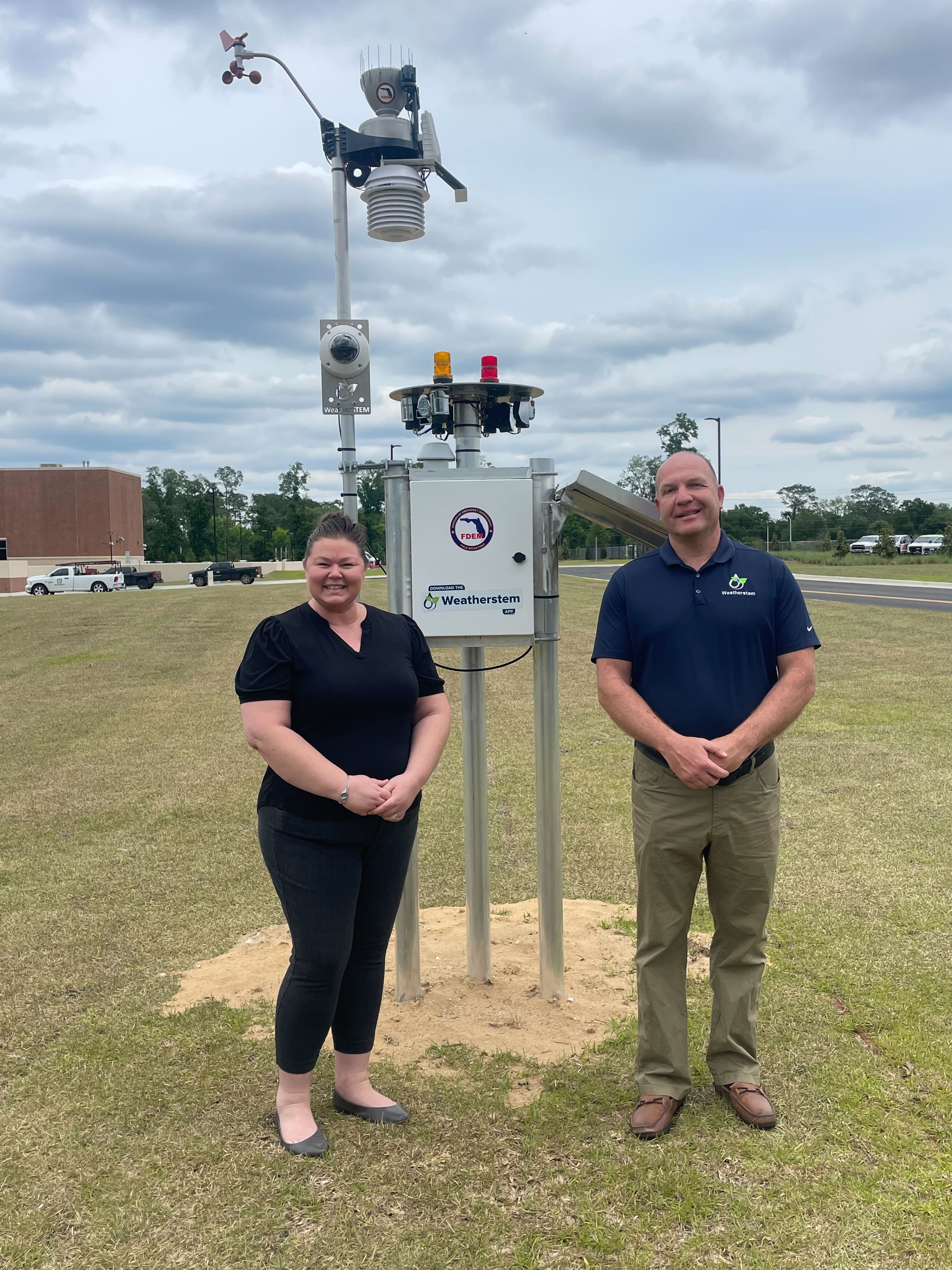
The Florida Division of Emergency Management operates one of the largest state-level weather monitoring networks in the country, built on Weatherstem's Protect Pro+ hardware platform combined with a custom software integration.
The Florida Severe Weather Mesonet deploys Protect Pro+ units across Florida counties in partnership with local government agencies. The Pro+ is Weatherstem's hurricane and marine-rated configuration, designed for high-wind environments and coastal deployments, operating independently of local power and internet infrastructure on solar and cellular.
The network provides real-time situational awareness for the full range of Florida's severe weather threats including hurricanes, tornadoes, wildfires, flooding, and lightning. When a hurricane makes landfall, ground-truth wind and pressure data from stations across the storm's path provides operational data that offshore buoys and upper-air soundings cannot.
The partnership model connects state emergency management resources with local government co-deployment, sharing infrastructure costs while building a statewide data asset. Individual county emergency managers retain access to their local station data while FDEM maintains the network-level view.
The Protect Pro+ Configuration
The Protect Pro+ is Weatherstem's hurricane and marine-rated station, designed for high-wind environments and coastal deployments. Solar power and cellular connectivity mean it operates independently of local infrastructure — critical for pre-landfall staging and post-storm damage assessment when ground infrastructure is compromised.
Case Study: New Orleans OHSEP
Parish-Wide Monitoring and the AQI Addition After Super Fog
The Weather Channel covers the New Orleans Super Fog event and OHSEP's weather monitoring response.
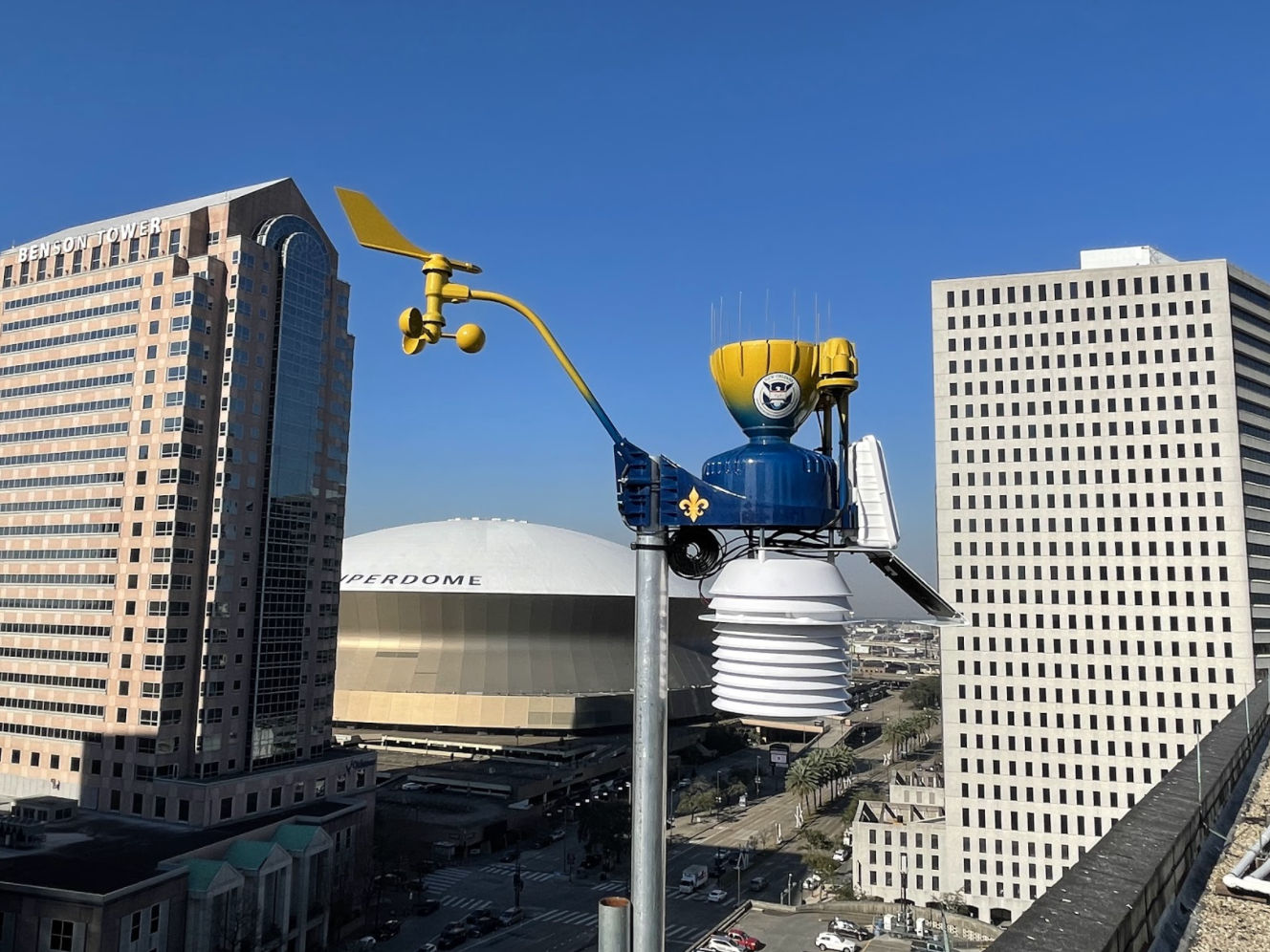
New Orleans Office of Homeland Security and Emergency Preparedness
New Orleans OHSEP operates 26 Weatherstem Protect Pro stations distributed across Orleans Parish for continuous monitoring of wind, rainfall, heat, and air quality conditions. The network gives the city's emergency operations team real-time situational awareness across neighborhoods with significantly different microclimatic conditions.
The Super Fog Event and AQI Integration: Following a Super Fog event that resulted in a mass pileup vehicle accident on a major New Orleans highway, OHSEP expanded the Weatherstem deployment to include Air Quality Index monitoring. The addition of PM2.5 sensors across the existing station network created an early warning capability for dangerous visibility and air quality events that affect both transportation safety and public health.
The AQI addition illustrates a key operational advantage of a managed hardware platform: the ability to add monitoring capability to an existing network without replacing infrastructure. Weatherstem stations are designed to accept additional sensors and parameters as operational requirements evolve.
Visibility and Air Quality Events
Super fog events, dense wildfire smoke, and industrial air quality incidents present rapid-onset risks that require immediate local data. Regional air quality monitoring stations are too sparse to provide the neighborhood-level resolution that urban emergency management requires. A distributed local network closes that gap.
The EM and Schools Partnership Model
How Emergency Managers and School Districts Share Weather Monitoring Infrastructure
Wayne County: Emergency Management and School District Partnership
The Wayne County deployment started with a single Weatherstem station at the county Emergency Operations Center. After seeing the operational value firsthand, the county emergency manager referred Weatherstem to the local school district, which added a station and four Blast outdoor warning sirens at a school athletic field.
Both organizations now share access to the Weatherstem platform. The emergency manager gets EOC situational awareness. The school gets lightning protection and automated warning coverage for their athletic programs. Two budget lines. Two operational needs. One shared infrastructure investment.
Why schools make effective partners for emergency management weather networks:
- Schools are geographically distributed across counties, creating natural coverage across multiple areas without redundant siting
- Schools frequently serve as emergency shelters during declared disasters, making on-site weather monitoring operationally valuable for both normal operations and emergency activation
- Athletic fields require weather monitoring for lightning compliance and heat safety, creating independent budget justification for the school side
- Shared infrastructure reduces per-unit cost for both parties
This model has been replicated in Walton County and Santa Rosa County, Florida, where emergency management agencies and school districts have jointly built monitoring networks that serve both daily safety operations and emergency response functions.
Download Wayne County Case Study (PDF)Grant Funding for Weather Monitoring Equipment
Weather monitoring systems that support life-safety decisions and hazard mitigation planning are generally eligible for federal grant funding. Emergency managers should work with their state emergency management agency and FEMA regional office to confirm eligibility for specific deployments.
Supports hazard mitigation projects before disasters occur. Weather monitoring networks that reduce risk to life and property by enabling faster, more accurate emergency response decisions are within the program's scope.
Activated following a presidential disaster declaration. Funds projects that reduce the risk of future disaster losses. Post-disaster monitoring network expansions are commonly funded through HMGP.
Supports the development of core emergency management capabilities. Equipment that enhances situational awareness and operational decision-making during emergency operations is generally eligible.
State and urban area security grants that fund preparedness activities. Weather monitoring infrastructure that supports situational awareness for all-hazards planning may qualify under certain investment justifications.
Working with Weatherstem on Grant Applications
Weatherstem works directly with emergency management agencies and their grant administrators to provide the documentation, specifications, and pricing information needed for grant applications. Contact our team early in the process so we can support your application with the right technical documentation.
What to Look for in a Weather Monitoring System for Emergency Management
Not all weather monitoring systems are built for emergency operations. Here is what matters operationally when the system is being used for life-safety decisions.