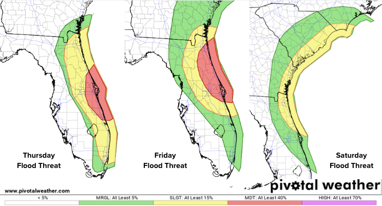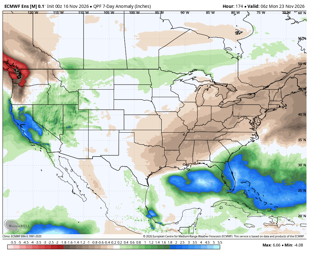
The busy Thanksgiving travel season begins this weekend, and a developing coastal storm could bring weather impacts to portions of the East Coast. Meanwhile, Florida will get a brief break from the heavy rain that has plagued the state this week, but another active weather pattern will bring additional chances for rain during the holiday week. The seven-day precipitation anomaly map below highlights the active pattern, with above-average precipitation expected across portions of both the East and West Coasts and the Gulf.
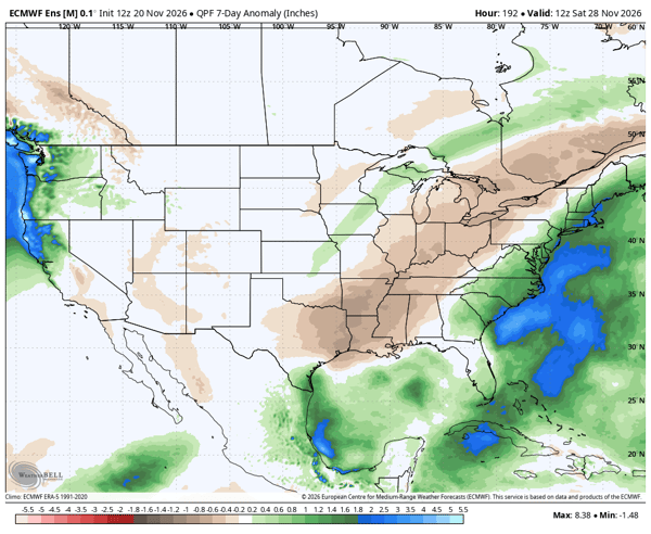 Above-average rainfall is forecast along portions of both the East and West Coasts, as well as the Gulf Coast, highlighting the potential for an active weather pattern heading into Thanksgiving.
Will a Coastal Storm Impact the East Coast?
A complicated weather pattern is developing across the Southeast, with two areas of low pressure expected to influence conditions over the coming days. One is developing over northern Florida, while another is located farther east over the Atlantic. The Florida system is expected to remain inland, limiting its potential for tropical development but bringing additional rainfall to an already saturated region.
The Atlantic system is expected to move northwest toward the East Coast and could develop subtropical or tropical characteristics this weekend. Watch the potential evolution below:
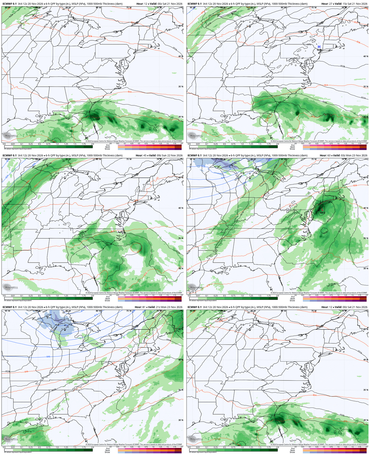 The National Hurricane Center has lowered the odds of tropical or subtropical development to 40%. However, the potential for development is only one part of the forecast. Rain, coastal winds, and elevated surf could still affect portions of the East Coast this weekend.
What Impacts Will the East Coast have this Weekend?
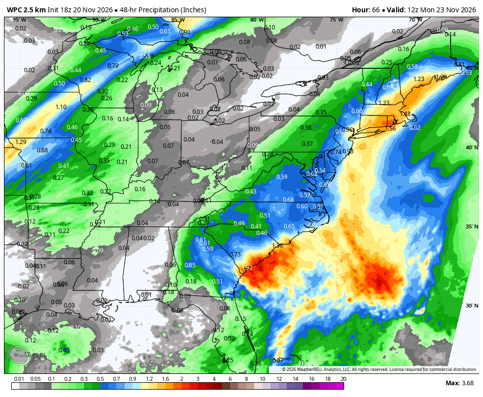
Rain will fall along portions of the East Coast this weekend, although totals will be much lower than what Florida has experienced this week. Below is the 48-hour rainfall forecast from 7 a.m. Saturday through 7 a.m. Monday.
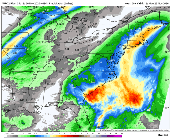 There are two areas where heavier rainfall is expected, along the South Carolina coast and across New England. South Carolina and portions of New England are experiencing significant drought, so the additional rainfall will be welcome in many locations. However, locally heavy rain could still create flooding concerns, particularly in areas with poor drainage.
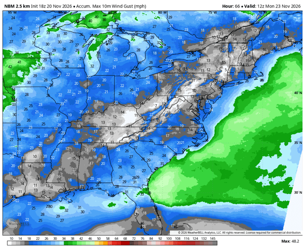
Fortunately, the strongest winds are expected to remain offshore, as shown in the forecast below. However, gusty conditions are still possible along portions of the coast.
These winds will also increase wave heights and create hazardous surf conditions. Strong waves are expected to spread northward along the East Coast from Saturday through Monday.
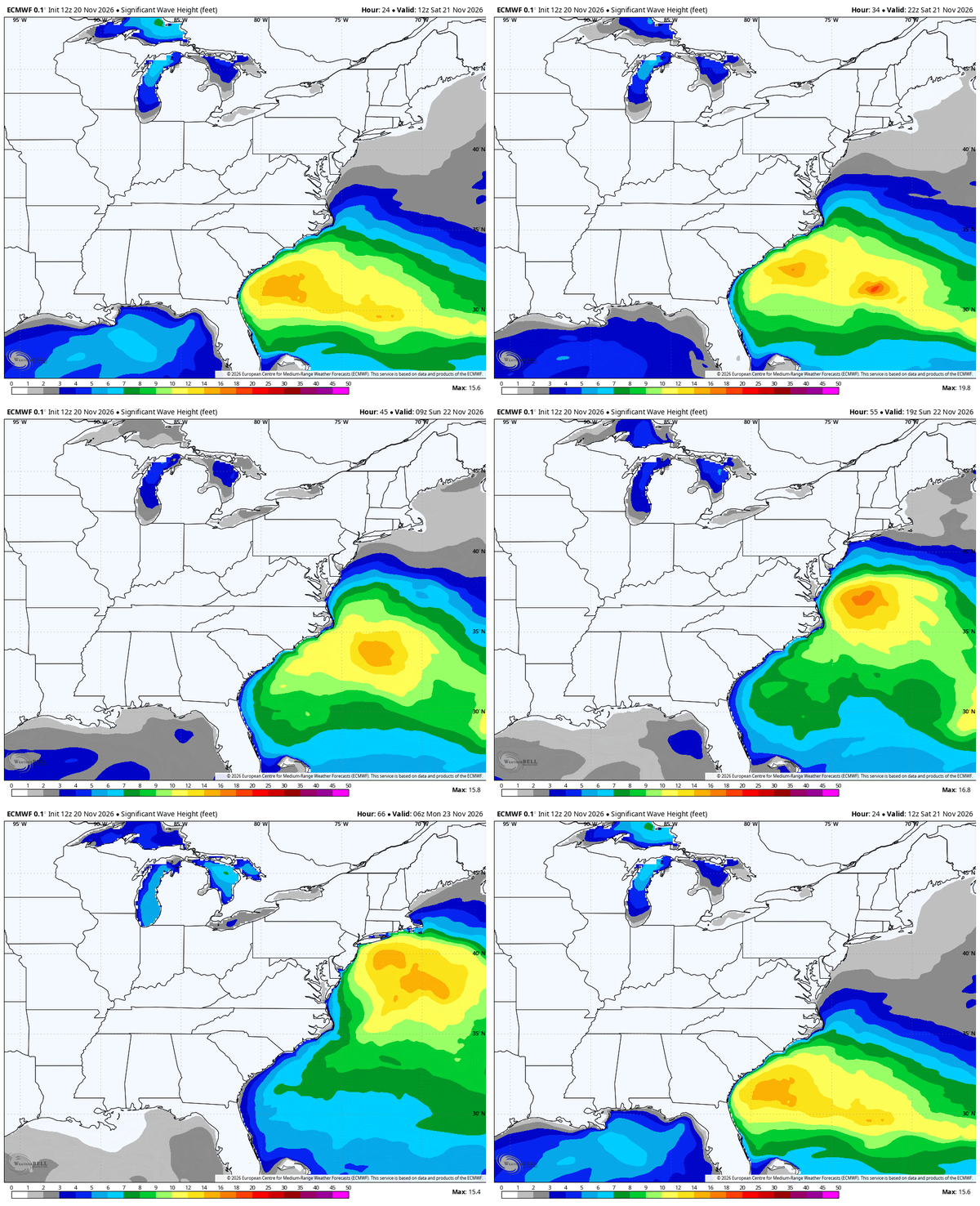
These coastal impacts will develop regardless of tropical or subtropical development.
Will Florida Have Drier Weather this Weekend?
One of the biggest weather stories this month has been the extraordinary amount of rainfall across parts of Florida. Some locations are already approaching or exceeding their previous November rainfall records. Our station at Port Canaveral has recorded nearly 30 inches of rain this month, with at least half of that falling just this week.
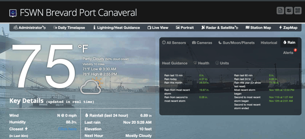 Rain chances should gradually decrease over the weekend as the current system moves northward. However, another system could bring additional rainfall to Florida by the middle of next week. For now, the heaviest precipitation is forecast to remain offshore, but the forecast could change as this active pattern evolves.
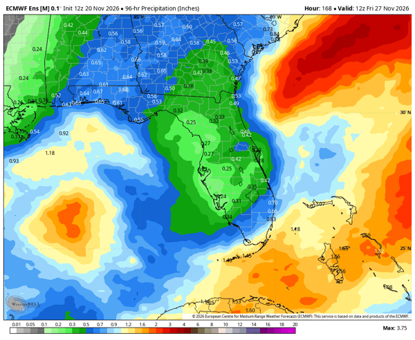 Any additional rain will hamper recovery efforts and prolong the river flooding.
What Does Thanksgiving Week Weather Look Like?
The week begins with this weekend's coastal storm moving away from New England, but the active pattern may not be over. Another area of low pressure could develop along the East Coast heading into Thanksgiving. Take a look at the recent runs of the ECMWF AI Forecasting System (AIFS) for Thanksgiving morning. Several runs have consistently shown a coastal low developing near the Mid-Atlantic coast.
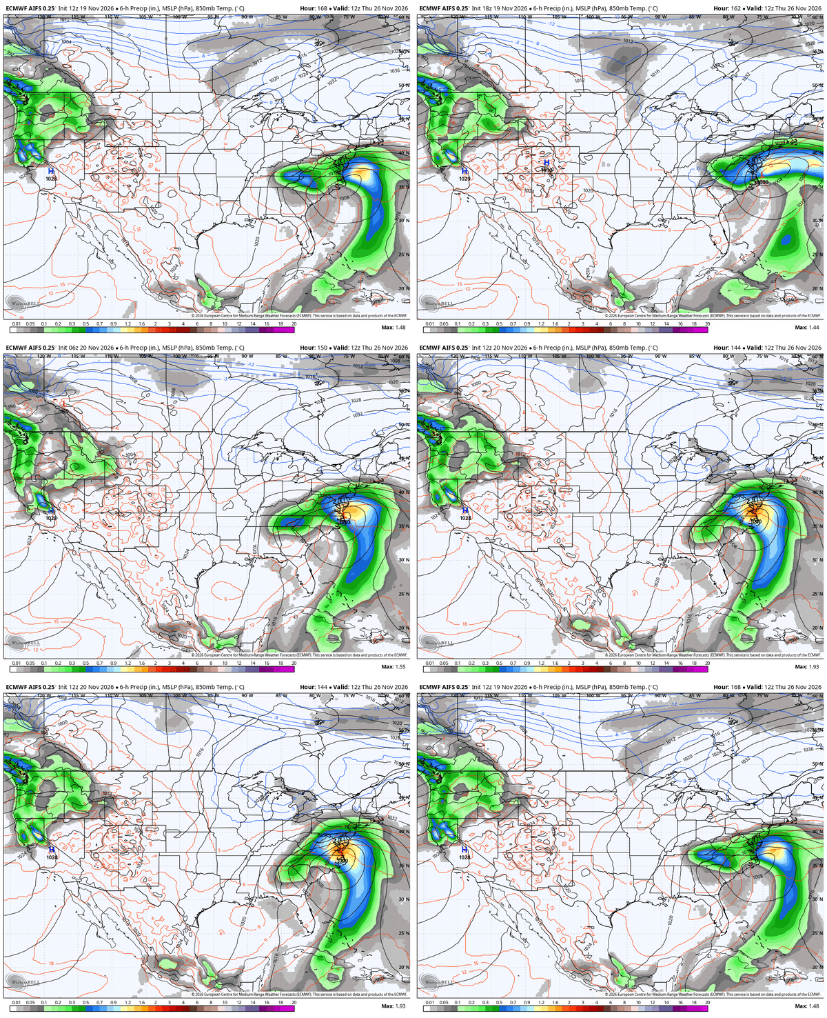
If this scenario develops, it could bring another round of heavy rain and gusty winds to portions of the East Coast, potentially affecting holiday travel. There is still considerable uncertainty in the timing and track of this potential system, so the forecast will need to be monitored closely as Thanksgiving approaches.
Monitor Changing Weather Conditions with Weatherstem
From heavy rainfall and flooding to coastal winds and changing weather conditions, localized observations help emergency managers maintain situational awareness. Weatherstem provides real-time weather monitoring and historical data to support informed decision-making.
Learn how Weatherstem can support your organization's weather monitoring needs.
Weatherstem
Real-time weather monitoring for the organizations that can't afford to guess.
Professional hardware, live HD camera, automated alerts, and software — installed and managed for you. 900+ stations deployed nationwide across emergency management, athletics, and commercial operations.
Book a Free Demo