
With only a couple of weeks left in meteorological Spring, an increase in severe weather will be noticeable as will an increase in temperatures. A ridge of warm air will build across the Eastern US while a trough dives into the West. This will lead to increasing heat across the east and the increase in severe weather in the center of of the country. Let’s breakdown the threats as we head closer to Memorial Day weekend and the unofficial start to summer.
 Severe Weather Risks Increase
So far this year, the US has had just over 620 tornado reports which is just slightly above average through May 12:
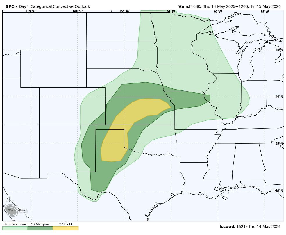
 That number will likely increase over the next several days and into Memorial Day weekend as a more active severe pattern will ramp up. First up, Thursday’s risk focuses on the Southern Plains where the biggest threat will be damaging winds:
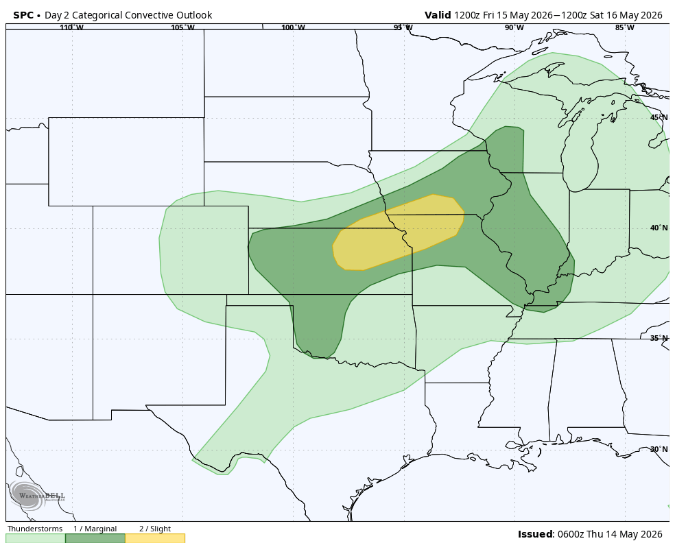
On Friday, the severe risk area expands north and east:
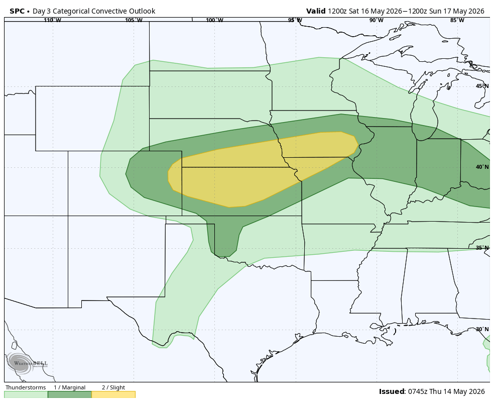
Then, this weekend into next week, the severe threat will continue across the Central US. Saturday's Outlook:
Sunday's Outlook:
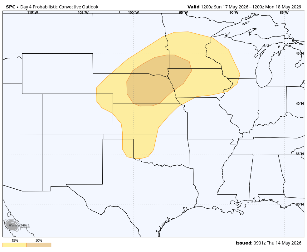
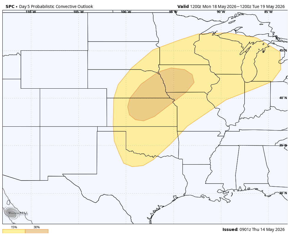
Monday's Outlook:
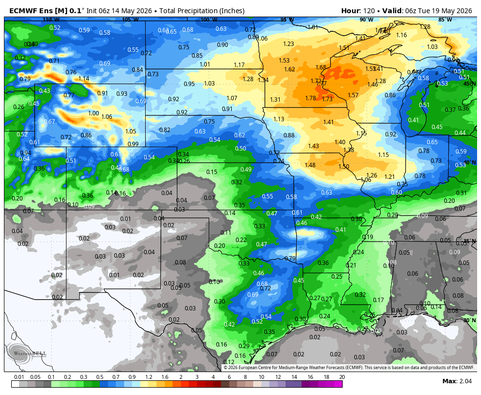
The rain totals during this stormy pattern will start to add up, with widespread 1-2″ amounts likely and locally higher amounts possible where heavier storms add up. Below is the rain total through Tue May 19 at 8 am ET:
Be sure to monitor the forecast closely if you live in this area. With so many outdoor activities this year, it is important to have weather monitoring for safety reasons. Reach out here to learn more about our weather monitoring: https://www.getweatherstem.com/protect-weather-station-camera-alerts
The East Heats Up
As the ridge builds across the Eastern US, some of the warmest temperatures of the season will develop. This includes the potential record highs. On Saturday, just a couple of records are possible:

A few more records are possible on Sunday with 90° highs reaching all the way to the Washington, DC area:

Even more records are possible by Monday as the 90° temperatures reach into Michigan:

Memorial Day Weekend Outlook
We are now in the time frame where we can get a general idea of what the weather for Memorial Day Weekend could look like. First up is temperatures where it looks like much of the country will have above-average temperatures:

As far as precipitation goes, the Southern Plains look to be the one part of the country with the best chance for above average rain:

In the days ahead, we can fine tune the forecast for the holiday weekend and the unofficial start to summer. Regardless, it's the time of year where both severe storms, lightning, and extreme heat need to be monitored!
Weatherstem
Real-time weather monitoring for the organizations that can't afford to guess.
Professional hardware, live HD camera, automated alerts, and software — installed and managed for you. 900+ stations deployed nationwide across emergency management, athletics, and commercial operations.
Book a Free Demo

