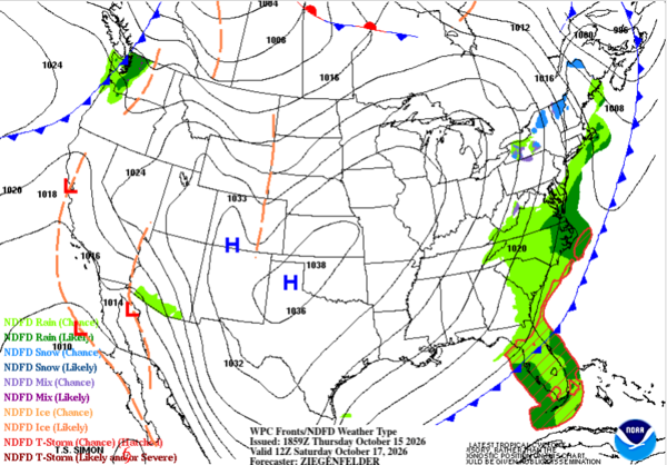
Many locations across the eastern U.S. have experienced record-high temperatures this week, including all-time October records and the latest 90°F high on record at some locations. A significant change is coming, however. A potent cold front will move off the East Coast later this week, bringing much cooler temperatures and the potential for the first frost of the season in some areas.
The front will also usher in strong, gusty winds along the Eastern Seaboard, setting up several days of hazardous coastal conditions. A coastal storm could develop along the front next week, but dangerous surf, rip currents, and coastal flooding are possible before any storm forms.
What Coastal Hazards Will The East Coast Face This Weekend?
As high pressure builds behind the cold front, persistent northeasterly winds will drive a prolonged period of elevated surf, increased rip current risk, and possible coastal flooding. Winds will be strongest along the coast, especially across Northeast Florida, where gusts could reach 40 mph.
Peak Wind Gusts Through Monday, October 19
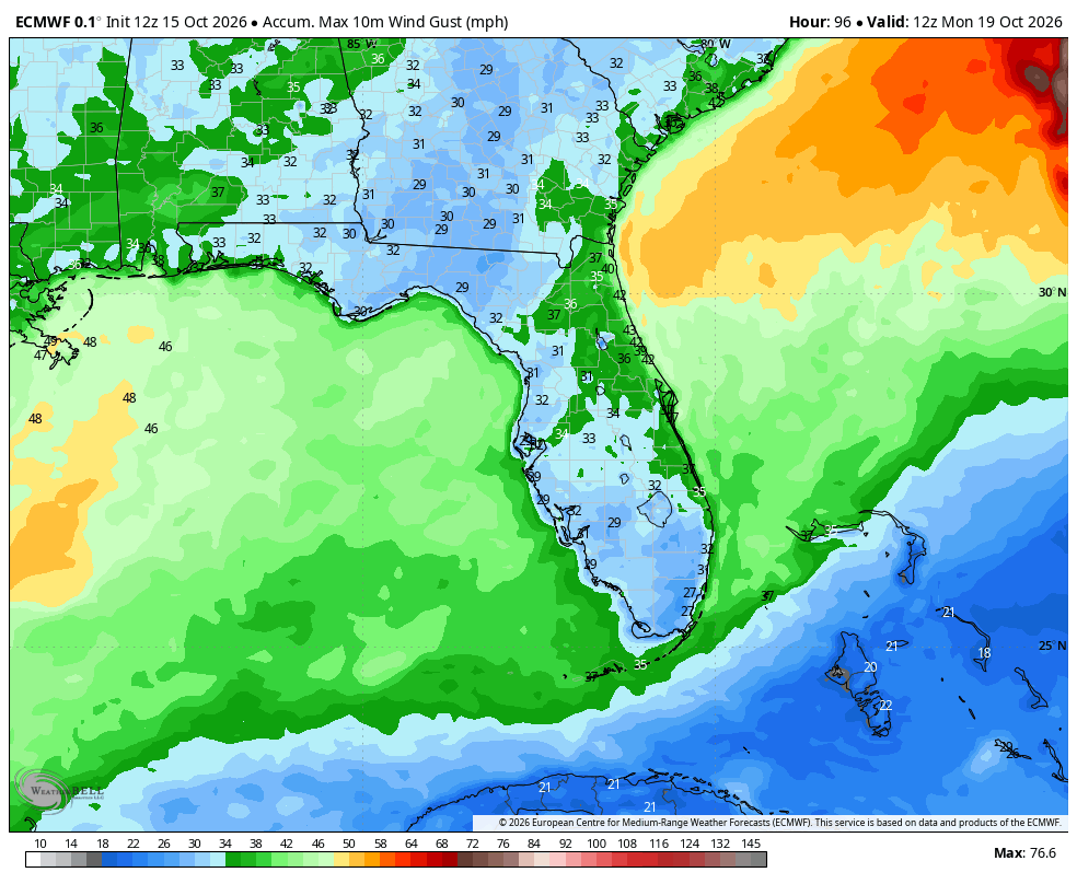
These winds will blow onshore, pushing water toward the coast and building waves. The wave forecast below shows significant wave heights increasing from Saturday afternoon into Monday morning.
Wave Forecast Saturday Afternoon through Monday Morning
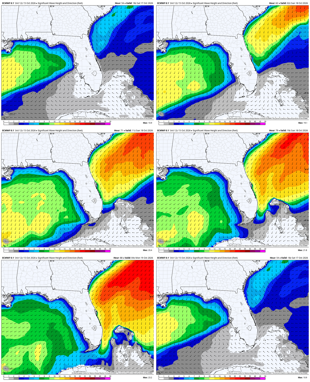
Significant wave heights could reach 10 to 12 feet by Monday morning. The combination of elevated surf and persistent onshore winds will also increase the risk of dangerous rip currents throughout the weekend. Minor coastal flooding is possible, particularly during high tide.
Will Florida Also See Rain and Storms This Weekend?
While coastal hazards will be a primary concern, periods of rain and thunderstorms are also possible across South Florida. The forecast below shows 48-hour rainfall totals from Saturday morning through Monday morning, with 2 to 3 inches possible across parts of the region.
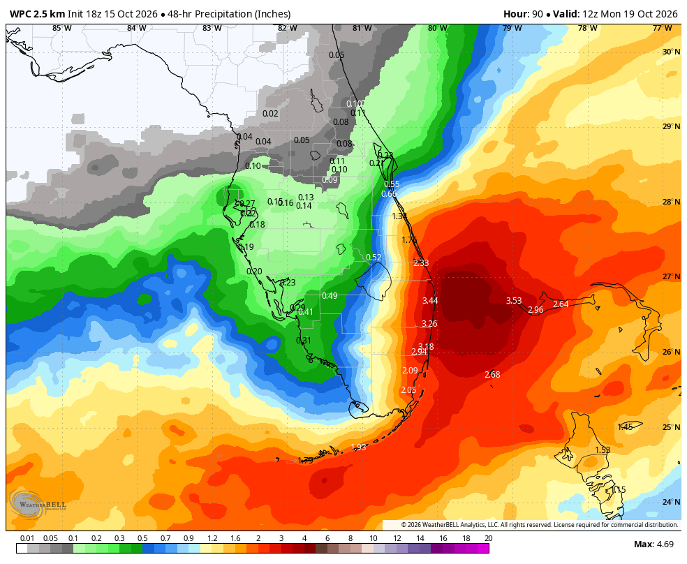
This rainfall could provide some relief to parts of South Florida that continue to experience drought conditions, although the benefits will depend on where the rain falls and how much accumulates.
Will a Coastal Storm Develop Along the Cold Front?
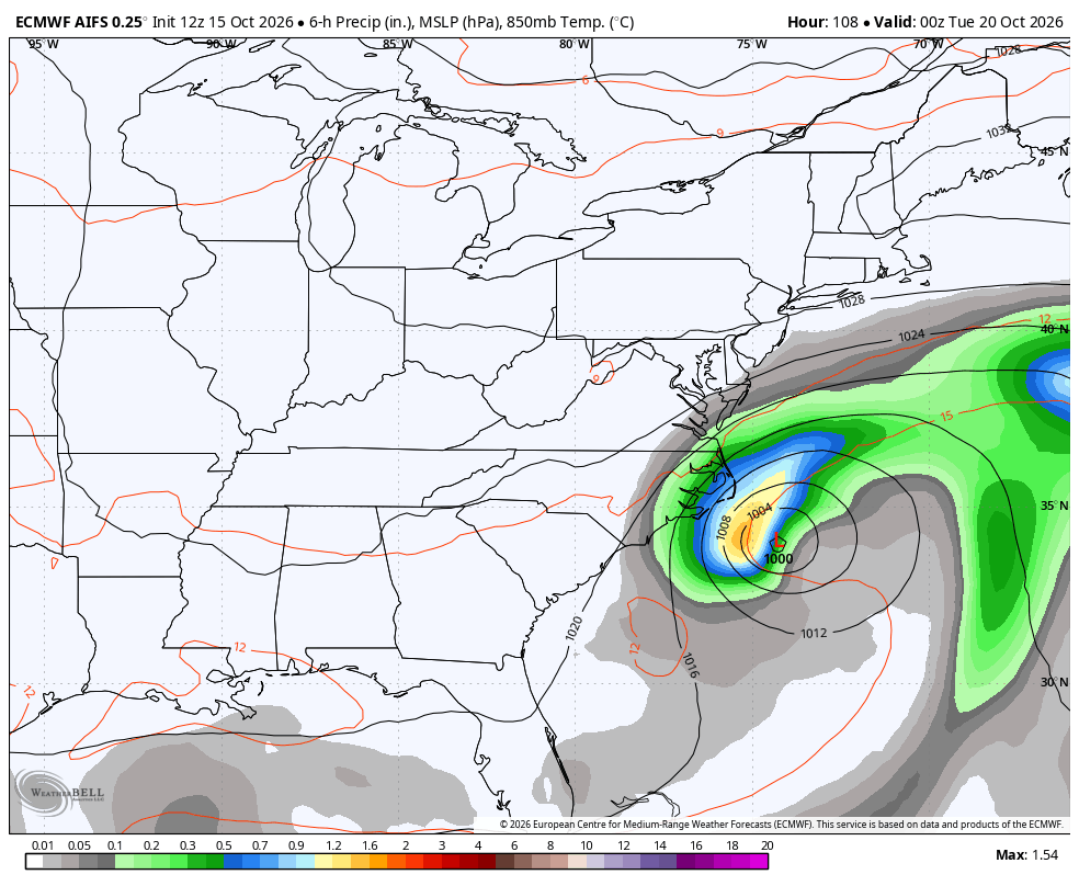
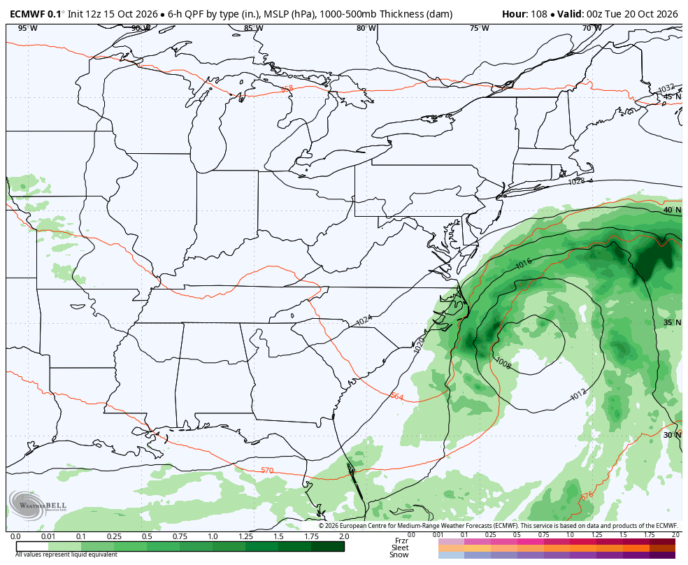
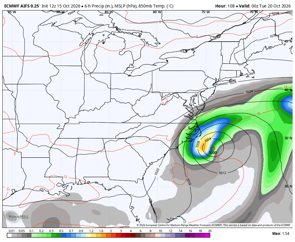
One of the biggest uncertainties in next week's forecast is whether a coastal low will develop along the front. Several forecast models are signaling the possibility of a more organized system offshore early next week.
Both the traditional, physics-based European model and its AI counterpart depict a significant system off the Carolinas by Monday night.
Traditional Physics-Based Euro Model:
 Euro AI Model:
The Google AI model, which performed exceptionally well during Hurricane Isaias, is also signaling the potential for a coastal storm by Monday night.
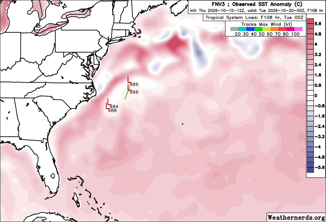
Although multiple models are indicating possible development, the strength and track of any coastal low remain uncertain. These details will determine whether the system brings additional wind, rain, and coastal impacts to the Mid-Atlantic and Northeast. We'll continue to monitor how the forecast evolves.
What Impacts Will the Carolinas See?
The Carolinas will also experience gusty winds and hazardous coastal conditions this weekend, even if a coastal storm does not develop next week. The Outer Banks and other exposed coastal areas could see wind gusts exceeding 40 mph.
Peak Wind Gusts Through Monday, October 19
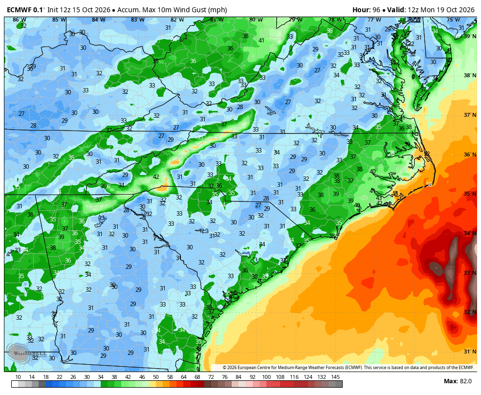
Waves will also build along the Carolina coast. The forecast below shows significant wave heights exceeding 10 feet in some areas by Sunday morning.
Wave Forecast Sunday Morning
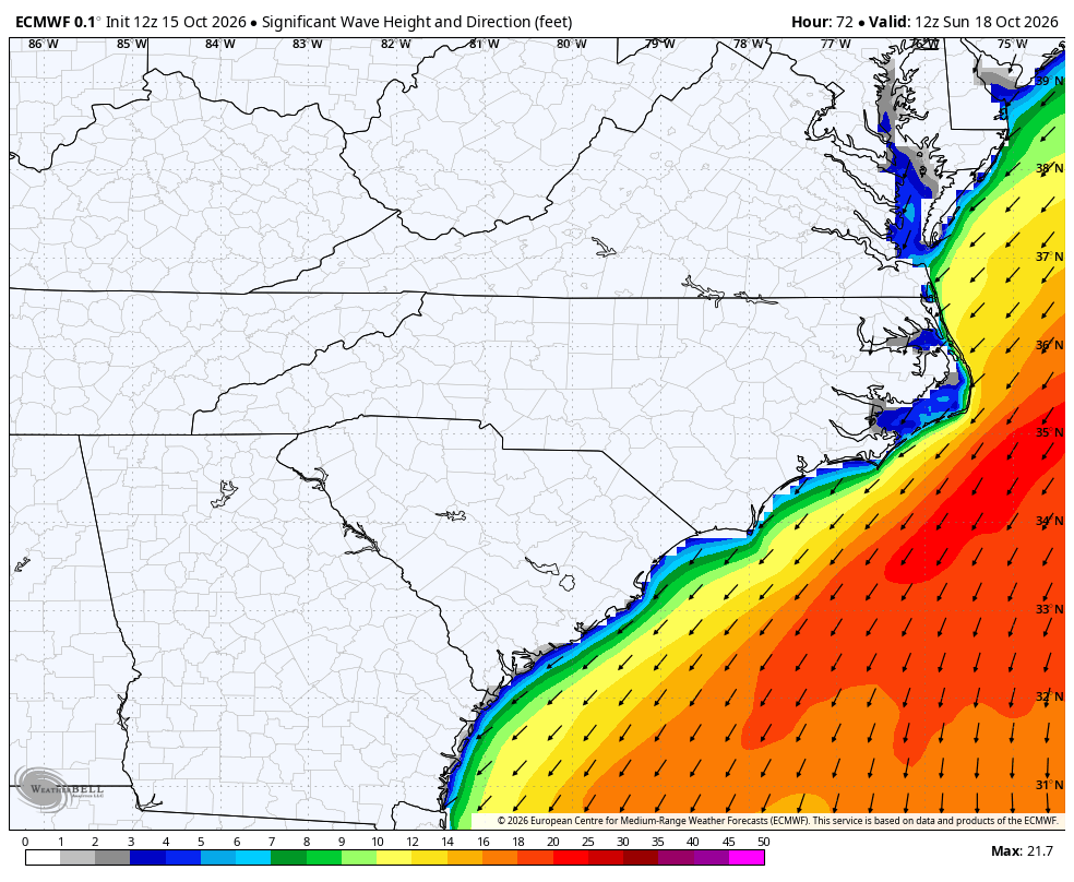
These hazards will develop before any potential coastal storm forms. If a storm develops and tracks close enough to shore, strong winds and elevated surf could persist into next week or intensify further.
Fall Temperatures Replace Record October Heat
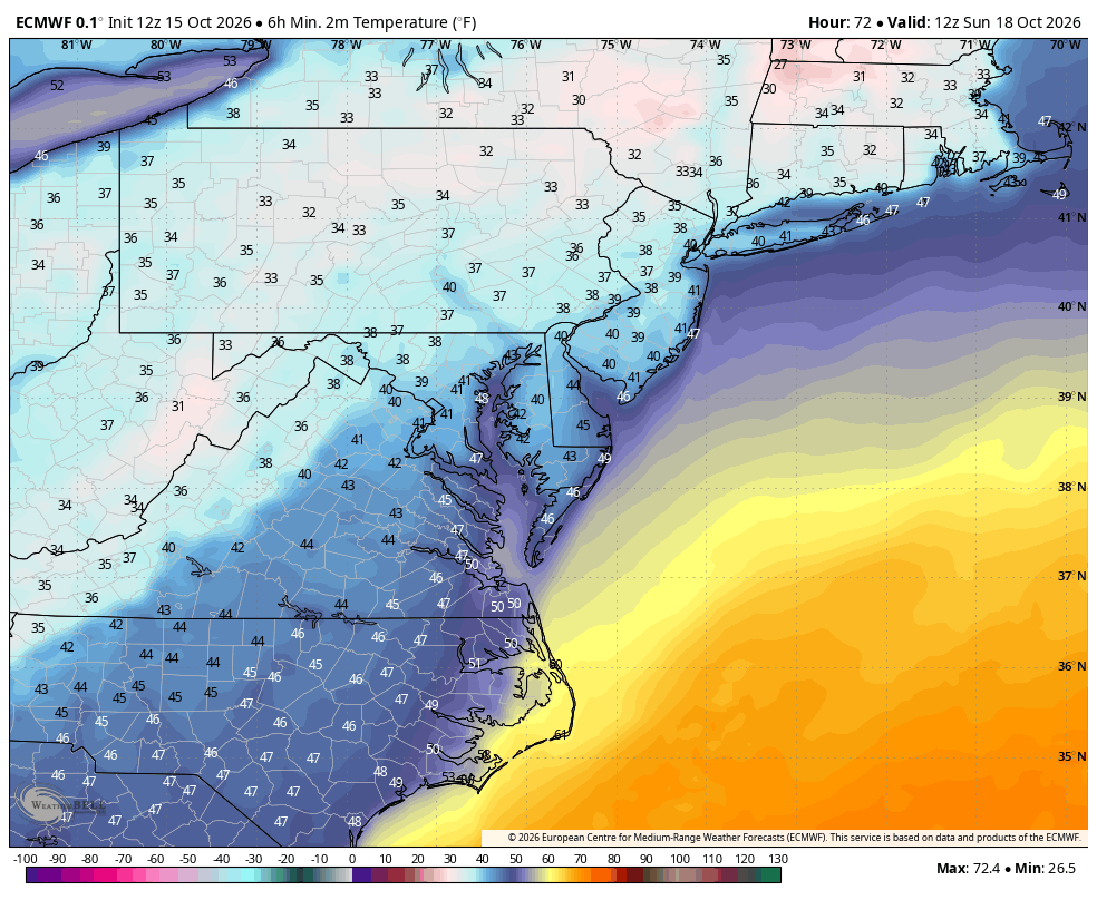
After a week of record-breaking warmth, the cold front will usher in a much cooler air mass. Temperatures will drop sharply across parts of the eastern U.S., with overnight lows in the 30s and 40s possible by Sunday morning. Some locations could experience their first frost of the season.
Sunday Morning Forecast Lows
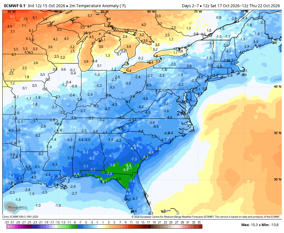
Northerly to northeasterly flow will help keep temperatures below average into next week. The five-day temperature anomaly forecast below shows cooler-than-average conditions across much of the eastern U.S. through Thursday, October 22.
What coastal hazards are expected along Florida's East Coast this weekend?
Strong northeast winds are expected to produce elevated surf, increased rip current risk, and possible minor coastal flooding. Coastal erosion may also occur where persistent wave action affects beaches.
Why will Florida experience dangerous surf without a tropical storm?
Strong northeast winds behind a cold front can blow toward the coast for an extended period, building waves and increasing water levels near shore even without a tropical system.
Could a coastal storm develop along the East Coast next week?
Some forecast models indicate that a coastal low could develop off the Carolinas early next week. The timing, track, strength, and potential impacts remain uncertain.
Will the Carolinas experience coastal hazards this weekend?
Yes. Gusty winds and elevated surf are possible along the Carolina coast, including the Outer Banks, before any potential coastal storm develops.
Weatherstem
Real-time weather monitoring for the organizations that can't afford to guess.
Professional hardware, live HD camera, automated alerts, and software — installed and managed for you. 900+ stations deployed nationwide across emergency management, athletics, and commercial operations.
Book a Free Demo