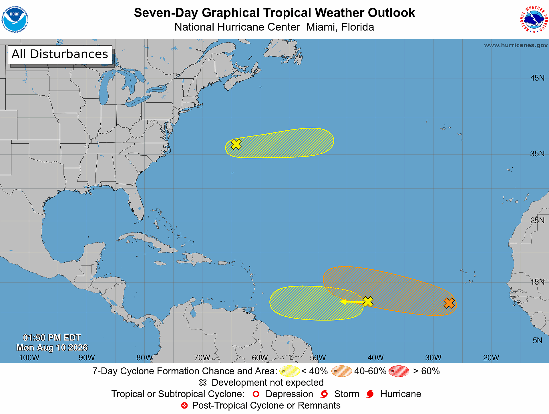
August signals the beginning of the peak of the Atlantic Hurricane season and right on cue, three areas are being monitored for possible development by the National Hurricane Center. However, the more significant tropical threat to the United States may actually come from the Pacific, as Hawaii has the potential to be impacted by a tropical system later this week.
If you remember from our tropical season outlook in June, we mentioned that tropical activity near Hawaii could be possible during a strong El Niño year. In today's blog, we'll break down both the tropical potential in the Atlantic and the potential threat to Hawaii.
Three Areas to Watch in the Atlantic Basin
There are currently three areas being monitored for tropical development across the Atlantic Basin: one area north of Bermuda and two areas in the Main Development Region well east of the Caribbean.
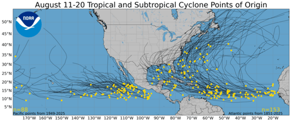
These are locations where you'd typically expect tropical formation this time of year, as you can see in the image below showing tropical and subtropical points of origin from August 11-20.
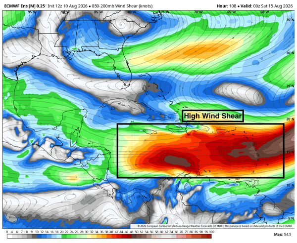
The area farthest north will move away from land and only has a 10% chance of developing before it moves into cooler waters later this week. The area farthest west in the Main Development Region also only has a 10% chance of developing as it approaches the Lesser Antilles. It would need to develop before reaching the islands to have much potential for further strengthening due to the exceptionally strong wind shear currently in place and expected to remain across the Caribbean:
The area farther east in the Main Development Region has the highest chance of development at 60%, but it has a long way to go before it could impact any land. In fact, it would not even approach the islands until Sunday, August 16, as shown by the Euro ensemble forecast below.
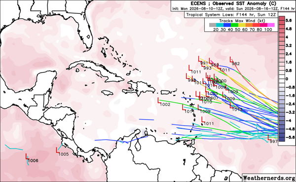 From there, it is expected to turn north. For now, this system is something to monitor rather than worry about, but it is a reminder that we are rapidly approaching the peak of the Atlantic Hurricane Season.
Potential Hawaii Tropical System
While the Atlantic has three areas to watch, the greater tropical concern for the United States may currently be in the Central Pacific. There are currently two areas being monitored by the National Hurricane Center in the Central Pacific that could impact Hawaii:
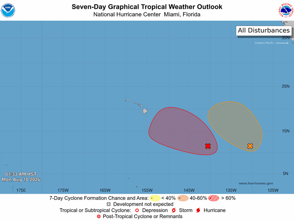 The area farther west, known as Invest 93C, has a 90% chance of developing. It is expected to move north before turning west later this week, as shown by the forecast model tracks below:
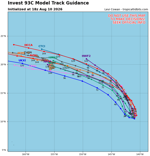 This path would take the system dangerously close to the Hawaiian Islands later this week and into the weekend. Intensity forecasts are also in relatively good agreement that Invest 93C will at least strengthen into a tropical storm, with some models bringing the system to hurricane strength, as shown in the intensity forecast plot below:
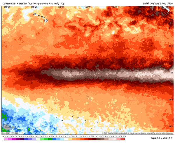
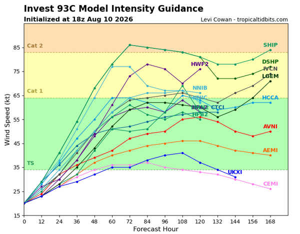 This potential for intensification is due in part to the exceptionally warm waters across the Pacific Ocean, which are associated with the strengthening El Niño. The current sea surface temperature anomaly around Hawaii is shown below:
Potential Hawaii Impacts
There is still considerable uncertainty in both the path and intensity of Invest 93C, but there is enough agreement among the forecast models to identify several potential impacts across Hawaii.
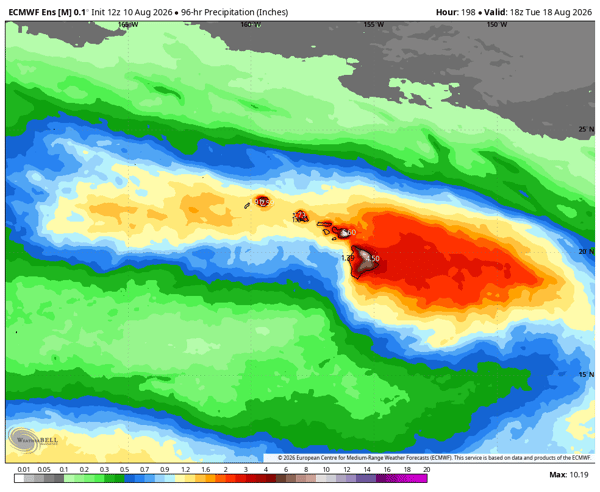
Heavy rain, with the potential for mudslides and landslides, would be the biggest concern at this point. The 4-day rainfall forecast ending Tuesday, August 18, from the Euro ensemble shows a solid 3-5 inches across the island chain, with higher amounts possible on the windward sides of the tall mountain peaks:
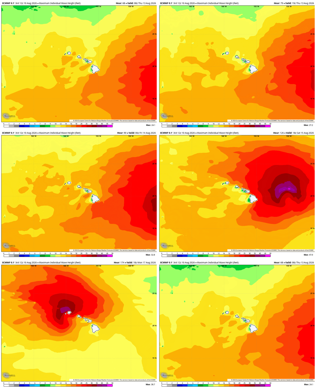
 Large waves and dangerous rip currents will also be possible as the system moves west near the islands. In the visualization below, you can see wave heights peak this weekend, with waves over 30 feet possible north of the islands:
 Wind impacts will ultimately depend on how strong the system becomes. That remains one of the biggest uncertainties in the forecast and is something we'll continue to monitor in future blogs later this week.
For now, the message is straightforward: the Atlantic is becoming increasingly active as we approach the peak of hurricane season, but Hawaii may face the more immediate tropical threat this week.
What is Invest 93C?
Invest 93C is an area of disturbed weather in the Central Pacific being monitored for potential tropical development. Its future track and intensity remain uncertain.
Could a tropical storm impact Hawaii?
Yes. Current forecast guidance indicates the potential for Invest 93C to move close to the Hawaiian Islands later this week, although the exact track and intensity remain uncertain.
What are the biggest threats from a tropical system near Hawaii?
Heavy rainfall, flooding, mudslides, landslides, large waves, dangerous rip currents and potentially strong winds could affect Hawaii depending on the system's eventual track and intensity.
Are there tropical systems developing in the Atlantic?
The National Hurricane Center is currently monitoring three areas for possible tropical development in the Atlantic Basin. Their chances of development and potential impacts vary significantly.
Weatherstem
Real-time weather monitoring for the organizations that can't afford to guess.
Professional hardware, live HD camera, automated alerts, and software — installed and managed for you. 900+ stations deployed nationwide across emergency management, athletics, and commercial operations.
Book a Free Demo