The first widespread weather event of 2026 will take place later this week. It will spread snow, rain, and storms from the Four Corners to the Eastern US. This system will come in two distinct waves that we will break down in today's weather update:
Thursday:

Friday:
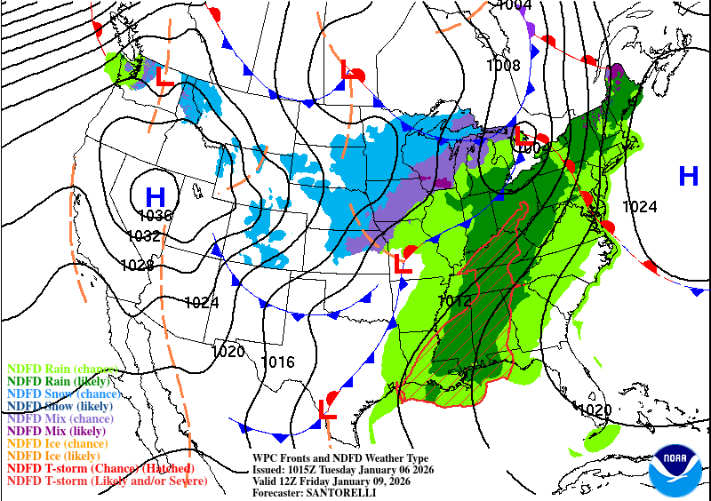
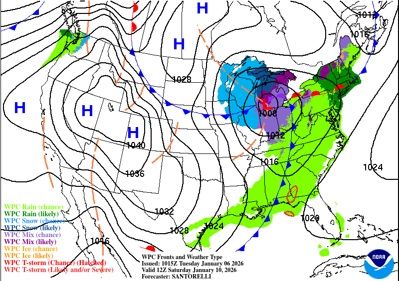
Saturday:
First up will be much needed snow across the Four Corners, including Colorado and Utah. While California has made up for its early-season snow deficit, the interior West is still running well below where it should be this time of year with many stations reporting less than 50% of where they should be for snow pack:
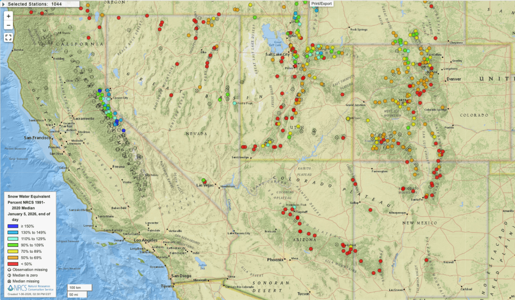
Snow will start across this region late Wednesday and last through Friday. While it won't completely erase the deficit, it will bring widespread snow especially to the higher elevations:

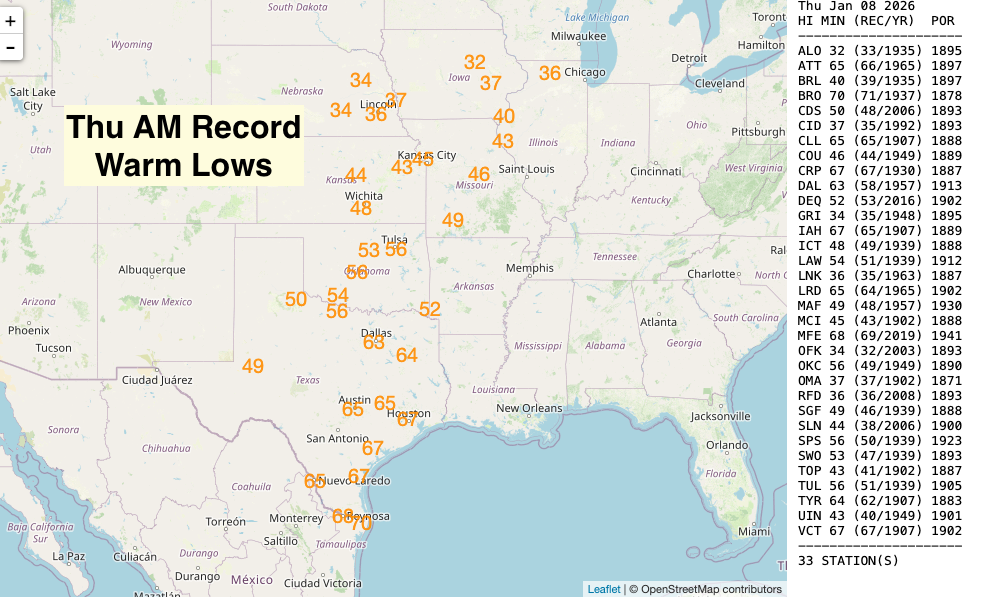
After bringing snow to the Southwest, the initial wave of precipitation then moves into the central part of the country and will bring mostly rain. Temperatures will be well-above average and even record-breaking, making it too warm for snow. The overnight lows will be the most impressive with over 130 record warm lows possible Thursday through Saturday morning:


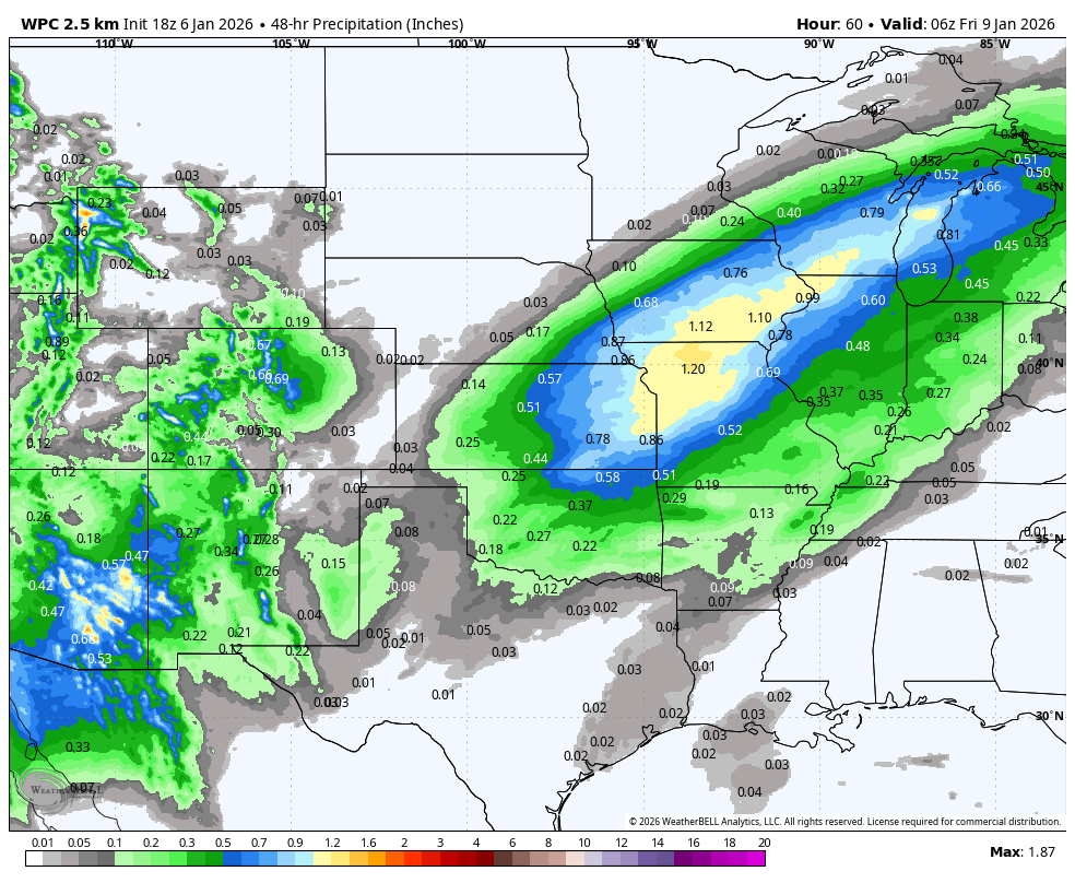
The first round of rain will be focused across the Central US and up into the Great Lakes. Below is the 48 hr rain forecast from 12 AM CT Wed to 12 AM CT Fri:
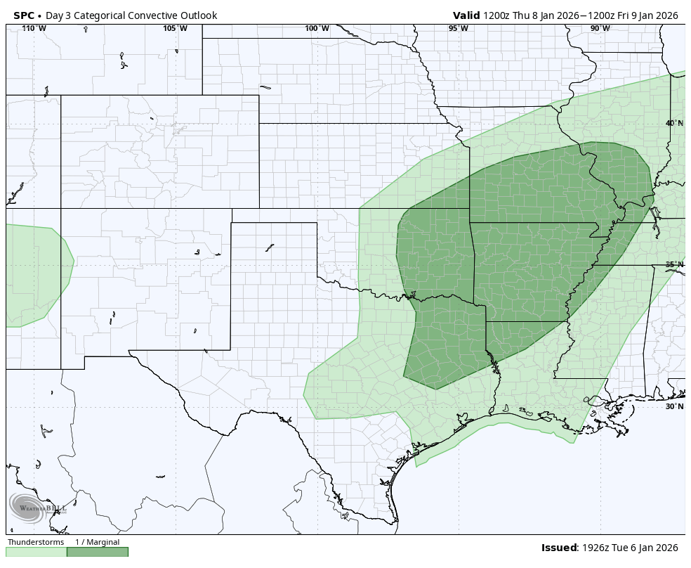
This rain will also bring the chance for severe thunderstorms Wednesday night and Thursday:

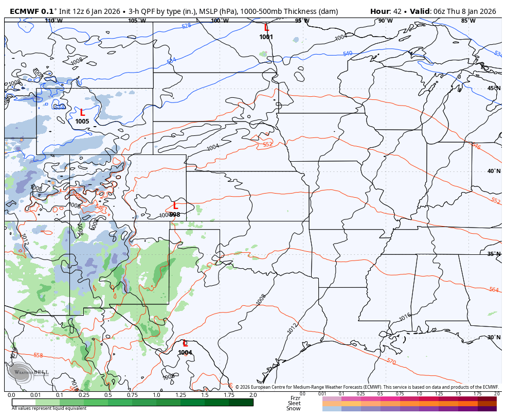
For that same time period you can see very little snow is expected as it is just too warm:

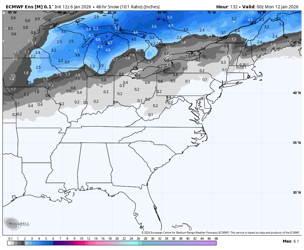
As the next wave of precipitation develops, it will meet cooler air brought down by the first round of rain. This means more snow will fall across the Central US especially into Iowa and Wisconsin. This snow will fall from Fri morning across the Southern Plains to early Sunday am across the Upper Midwest:

You can see the progression of both rounds of precipitation from early Thu AM to Sunday AM below:
For the Eastern part of the US, the main threat from this system will be rain and even some severe storms. Most of the precipitation for this region will fall as rain with only the areas near the Great Lakes getting snow like we mentioned above:
The rain will be heavy at times, especially across the Southeast from Eastern Tennessee to Mississippi:
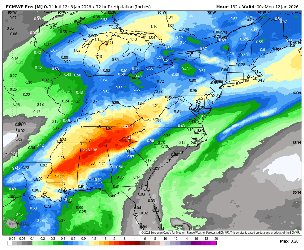
This is good news for parts of the Southeast that have seen drought expand over the Fall and Winter months:
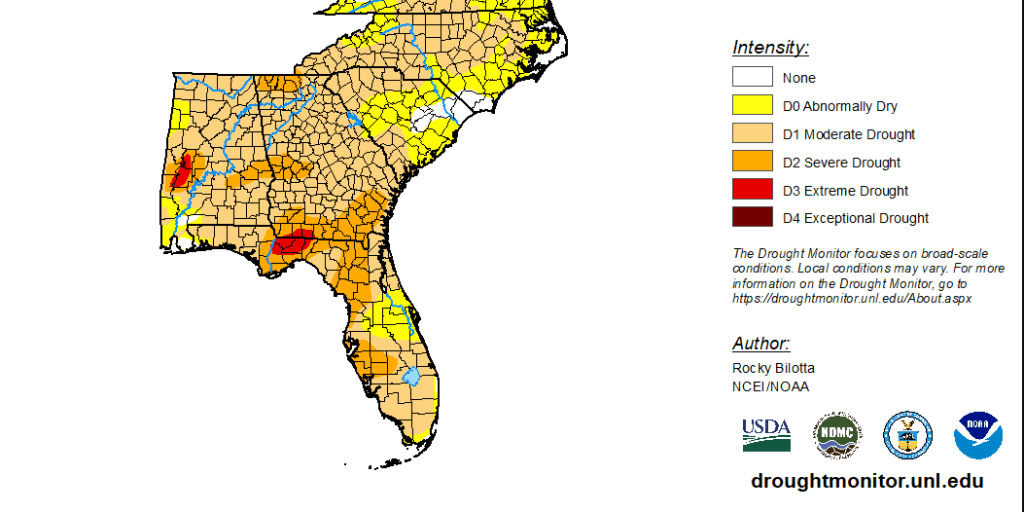
Unfortunately, not much of that rain will make it to the area that needs it most, Florida, with only the far Western Panhandle expected to get anything significant:

Weatherstem
Real-time weather monitoring for the organizations that can't afford to guess.
Professional hardware, live HD camera, automated alerts, and software — installed and managed for you. 900+ stations deployed nationwide across emergency management, athletics, and commercial operations.
Book a Free Demo

