Fire Weather Watches and Red Flag Warnings are among the most important forecast products issued during wildfire season. While both indicate the potential for dangerous fire weather, they serve different purposes and are often confusing. Understanding what these products mean and, more importantly, what actions the issuance of the products should induce, can help emergency managers improve situational awareness before and during wildfire incidents.
What is a Fire Weather Watch?
A Fire Weather Watch is issued to signal that fire weather conditions are possible 24 to 96 hours ahead of the expected onset of those conditions. This alert is issued by the National Weather Service (NWS) and is based on forecast conditions. It is used to bring awareness and that fire weather conditions could occur in the next couple of days.
The operational implications of a fire weather watch would allow emergency managers to prepare for possible fire weather. This includes the following:
1. Increase situational awareness
2. Review staffing plans
3. Inspect weather monitoring equipment
4. Brief agency leadership and coordinate with fire agencies
5. Review evacuation plans
6. Monitor forecast updates frequently
Fire Weather Watch means prepare!
What is a Red Flag Warning?
A Red Flag Warning is issued when conditions are occurring or expected soon. This usually indicates stronger confidence in a forecat for fire weather conditions.
- Corresponding operational actions by emergency managers may include the following:
- Increasing staff and enhanced EOC monitoring
- Coordination with incident command
- Increased public messaging
- Monitoring weather continuously
- Supporting evacuation readiness
Red Flag Warning means be ready to act!
How Should Emergency Managers Respond as Conditions Escalate?
As fire weather conditions become more likely, emergency managers should gradually increase their operational readiness. A Fire Weather Watch provides an opportunity to review plans, coordinate with partner agencies, and closely monitor forecast updates. If conditions escalate to a Red Flag Warning, agencies may increase staffing, monitor weather observations more frequently, prepare public messaging, and ensure decision-makers have access to real-time situational awareness tools.
That section bridges the two products nicely and reinforces that preparedness is a progression, not an on/off switch.
What do the Storm Prediction Center Fire Weather Outlooks Mean?
In addition to Fire Weather Watches and Red Flag Warnings issued by local National Weather Service forecast offices, the Storm Prediction Center (SPC) publishes daily Fire Weather Outlooks that highlight areas where critical fire weather conditions are expected. Much like the SPC's Convective Outlooks for severe thunderstorms, these outlooks provide a broad view of wildfire potential across the country and help emergency managers anticipate where fire weather concerns may develop.
The categories for Fire Weather Outlooks are as follows:
- ELEVATED - elevated risk from wind and relative humidity
- CRITICAL - critical risk due to wind and relative humidity
- EXTREME - extremely critical risk from wind and relative humidity
- ISO DRY T-STORMS - elevated risk from dry thunderstorms (meaning lightning with little rain)
- SCT DRY T-STORMS - critical risk from dry thunderstorms

What Weather Conditions Trigger Fire Weather Watches and Red Flag Warnings?
Fire Weather Watch and Red Flag Warning criteria vary by National Weather Service forecast office because vegetation, climate, and fuels differ across the country. For example:
Chicago-area criteria:
-
Sustained winds of 20 mph or higher
-
Afternoon relative humidity less than 25%.
-
10 Hour fuel moisture at 8% or less for one day
Denver-area criteria:
-
Frequent gusts of 25 mph or greater and a relative humidity of 15% or less.
-
Dry Thunderstorms with 15% of more coverage.
-
Wind shifts associated with frontal passages.
-
First significant lightning event after an extended hot and dry period
-
Poor relative humidity recovery overnight (relative humidity remains at 40% or lower)
-
Any combination of weather and fuel moisture conditions which, in the judgement of the forecast, would cause extensive wildfire occurrences.
These differences illustrate why emergency managers should understand the fire weather criteria used by their local NWS forecast office. Knowing the thresholds for your area helps agencies better interpret forecast products and prepare for changing fire conditions.
Why Aren't Forecast Products Enough During Wildfire Season?
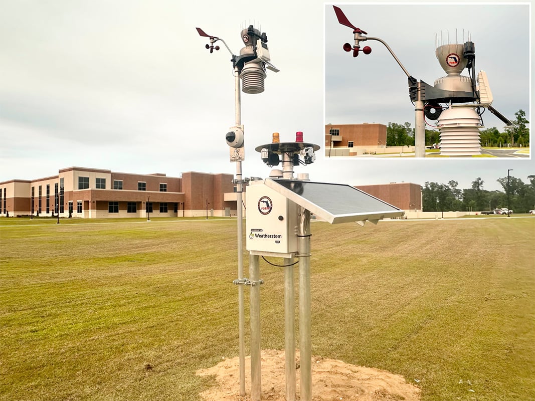
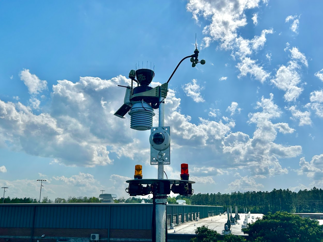
Forecasts for fire weather answer the "what is expected" question while weather stations and observations answer the question "what is happening". Hyper-local weather monitoring can help detect wind shifts due to local terrain and know when extreme gusts occur. They can also confirm low humidity thresholds and overnight recovery. The addition of cameras to weather stations gives visual confirmation of fires, smoke plumes, and even dry fuels.
| Forecast Products | Real-Time Monitoring |
| Anticipates conditions | Confirms current conditions |
| Provide regional coverage | Provides site-specific observations |
| Updated periodically | Continuous observations |
| Work as a planning tool | Works as operational decision support |
How Can Emergency Managers Build a Better Fire Weather Monitoring Strategy?
A comprehensive wildfire monitoring strategy combines forecast products with real-time observations from multiple sources. Weather stations provide local measurements of wind, humidity, temperature, and rainfall. Live weather cameras add visual confirmation of smoke movement, visibility, and changing conditions. Lightning monitoring helps identify potential new fire starts, while shared dashboards allow emergency managers to view weather alongside evacuation routes, active incidents, and other operational information. Together, these tools create a more complete common operating picture before and during wildfire incidents.
The Bottom Line
Fire Weather Watches and Red Flag Warnings provide valuable advance notice of potentially dangerous wildfire conditions. However, forecasts alone don't provide the complete operational picture.
Emergency managers who combine forecast products with real-time weather observations, live cameras, and continuous situational awareness are better equipped to make informed decisions before and during wildfire incidents.
Want to strengthen your wildfire monitoring capabilities? Weatherstem's weather stations, live cameras, and operational weather platform help emergency managers monitor changing fire weather conditions and improve situational awareness before and during wildfire incidents. Contact Weatherstem to learn more: https://www.getweatherstem.com/contact-weatherstem

Weatherstem
Real-time weather monitoring built for compliance and life-safety decisions.
Professional hardware, dual lightning detection, automated alerts, and permanent data logging — installed and managed for you. Used by emergency management agencies, athletic programs, and government operations nationwide.
Book a Free Demo.jpg)