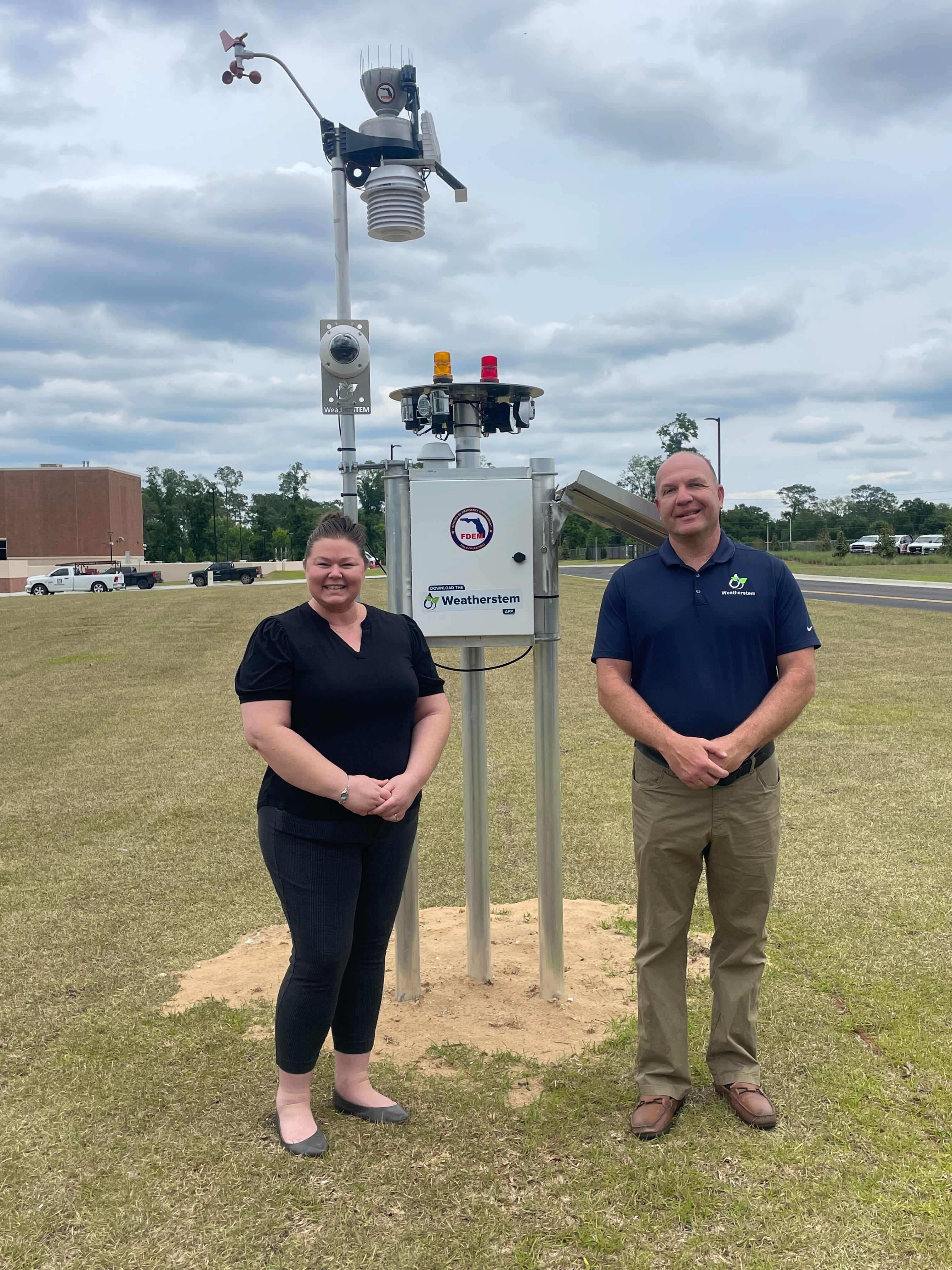
When severe weather affects Florida, emergency managers depend on many sources of information to understand what is happening on the ground. Radar, forecasts, National Weather Service products, local reports, and surface observations all contribute to that operating picture.
The Florida Severe Weather Mesonet adds another important layer: a statewide network of locally hosted weather monitoring systems providing hyperlocal observations from strategic locations across Florida.
The program is administered by the Florida Division of Emergency Management (FDEM), with Weatherstem providing weather monitoring systems, technology, installation, software, and support. Counties, municipalities, public agencies, universities, and other participating organizations host equipment within their communities and help extend the network across the state.
It is a model built around state coordination, local participation, and private-sector implementation, with a common goal of improving situational awareness before, during, and after severe weather.
What Is the Florida Severe Weather Mesonet?
A mesonet is a network of weather monitoring stations distributed across a geographic area to capture local variations in conditions that broader observing networks may not see at the same geographic resolution.
That is particularly useful in Florida, where hurricanes, severe thunderstorms, tornadoes, flooding, wildfires, lightning, and extreme heat can produce significant differences in conditions over relatively short distances.
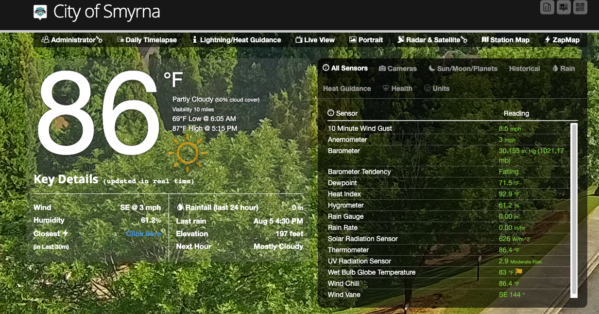
The Mesonet complements existing weather information by adding surface observations from participating locations throughout the state. Depending on the site and system configuration, observations can include wind speed and direction, rainfall, atmospheric pressure, temperature and humidity, and camera imagery.
The goal is straightforward: provide emergency managers with additional real-time information from locations within the communities they serve, while also contributing those observations to a broader statewide operating picture.
By the end of FY 2024-25, the statewide Weatherstem deployment had grown to more than 240 weather monitoring stations. Phase 7 for FY 2025-26 added another 41 weather monitoring units, 21 water-level monitoring units, camera software enhancements, and continued support for eligible systems installed during an earlier phase.
Why a Mesonet, and Why Florida?
Florida's geography and weather make localized observations particularly valuable. Hurricanes, tropical systems, severe thunderstorms, sea breezes, flooding, and other hazards can produce very different conditions across relatively short distances.
A mesonet adds another layer of ground-level observations to radar, National Weather Service products, forecasts, airport observations, and reports from local agencies. Together, these sources help emergency managers build a more complete picture of conditions as an event develops.
How the Program Is Structured
One of the strengths of the Florida model is that responsibility is shared across state coordination, local participation, and technical implementation.
Florida Division of Emergency Management
FDEM administers the statewide initiative, coordinates with participating organizations, and oversees the use of legislative funding to expand and sustain the network.
The Mesonet supports FDEM's broader mission of maintaining situational awareness and supporting operational decision-making during severe weather and other incidents.
Local Host Entities
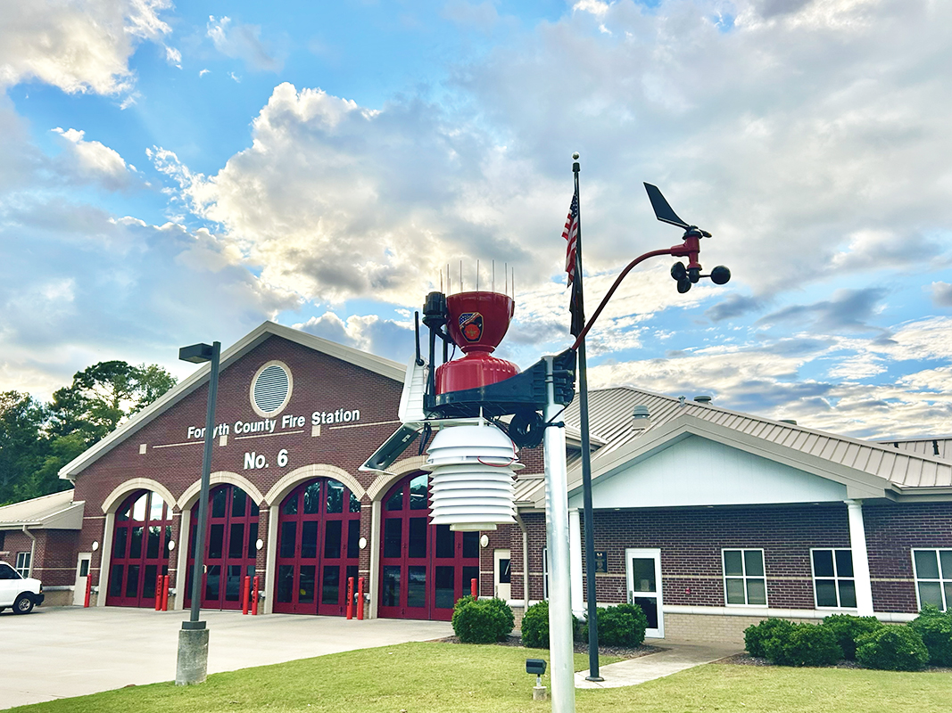
Participating counties, municipalities, agencies, universities, and other organizations host systems within their communities.
This local role is important. It places observations close to the people making local decisions while also contributing those observations to a broader statewide network.
The result is infrastructure that can provide value at both levels: locally for the agencies closest to an event and statewide for emergency managers looking at conditions across Florida.
Weatherstem
Weatherstem provides the monitoring technology, installation, software platform, data processing, dashboards, alerting capabilities, camera tools, and technical support associated with the program.
Together, these roles create a distributed network where local observations can be used individually while also contributing to a larger statewide view.
Built for Severe Weather Operations
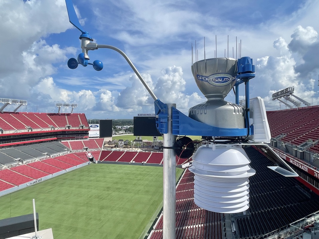
Mesonet deployments use solar-powered and cellular-connected Weatherstem monitoring systems designed for high-wind environments.
That architecture reduces dependence on a host facility's electrical power and internet connection, an important consideration for infrastructure intended to support severe weather operations.
During an event, observations from stations within affected areas can provide additional ground-level context alongside radar, forecasts, National Weather Service products, and reports from local agencies.
After an event, the same network can continue supporting situational awareness as agencies evaluate conditions and coordinate response activities.
The Mesonet is designed to complement the broader weather enterprise rather than replace any single source of information. Surface observations, radar, forecasts, National Weather Service products, local reports, and other systems each provide a different piece of the operational picture.
National Weather Service offices have also cited Weatherstem and Florida Mesonet observations in Local Storm Reports and post-storm analyses, including observations collected during hurricanes and other significant weather events.
Seven Phases of Continued Expansion
The Mesonet has expanded through seven phases from FY 2019-20 through FY 2025-26. The phased approach has allowed the network to expand geographically while continuing to support infrastructure installed during previous years.
| Phase | Fiscal Year | Scope |
|---|---|---|
| Phase 1 | FY 19-20 | 48 weather monitoring units deployed |
| Phase 2 | FY 20-21 | 50 weather monitoring units deployed |
| Phase 3 | FY 21-22 | 47 weather monitoring units deployed |
| Phase 4 | FY 22-23 | 30 weather monitoring units deployed; continued operational support for Phase 1 systems |
| Phase 5 | FY 23-24 | 40 weather monitoring units deployed; continued operational support for Phase 2 systems; location-based alerting enhancements |
| Phase 6 | FY 24-25 | 28 weather monitoring units deployed; continued operational support for eligible Phase 3 systems |
| Phase 7 | FY 25-26 | 41 weather monitoring units, 21 water-level monitoring units, camera software enhancements; continued operational support for eligible Phase 4 systems |
The phased structure is an important part of the Florida model. Rather than approaching statewide monitoring as a single deployment, the network has grown incrementally over multiple years.
Each phase has created an opportunity to expand coverage, respond to evolving operational needs, and build on the infrastructure already in place.
Expanding Into Water-Level Monitoring
Phase 7 represents an important expansion of the Mesonet beyond atmospheric observations.
Twenty-one water-level monitoring systems were added at designated locations across Florida, providing another source of real-time environmental information for participating agencies.
Florida's flood risk can vary significantly from one location to another, and localized water-level observations can provide valuable context during heavy rainfall, tropical systems, and other flooding events.
The addition of water-level monitoring demonstrates another benefit of the Mesonet model: once the statewide framework is established, new types of environmental observations can be incorporated into the broader operational picture.
What Other States Can Learn from the Florida Model
Florida is not the only state that can benefit from localized environmental observations. The experience of building the Florida Severe Weather Mesonet offers several useful lessons for agencies considering regional or statewide observation networks.
Local participation matters
Host organizations do more than provide a location for equipment. They connect statewide infrastructure with local operational needs and help ensure observations are available where decisions are actually being made.
Phased growth creates flexibility
Building the network over multiple years has allowed Florida to expand into additional locations while continuing to support earlier investments.
It also creates opportunities to incorporate lessons from previous phases and respond to new needs as the network grows.
Lifecycle planning matters
Weather monitoring infrastructure is more than the initial installation. Sensors, communications equipment, cameras, software, and data services all require ongoing attention.
Successful networks account for continued operation as part of the program rather than treating installation as the finish line.
A common platform creates value beyond an individual station
An individual weather station provides useful local information. A connected network creates a much broader operational resource.
Local observations become more valuable when agencies can view them alongside surrounding locations, weather alerts, camera imagery, and other information within a common platform.
Mesonets work best as part of the broader weather enterprise
A mesonet is not intended to replace radar, forecasts, National Weather Service products, airport observations, or other established sources.
Its value comes from adding another layer of localized ground observations to that larger information ecosystem.
A Model Built Around Shared Benefit
The Florida Severe Weather Mesonet demonstrates what can be accomplished when state leadership, local agencies, and private-sector technology are aligned around a practical public-safety need.
FDEM provides statewide coordination. Local organizations provide locations, participation, and operational context. Weatherstem provides the monitoring systems, software, installation, and technical support.
The result is infrastructure that can serve both statewide situational awareness and the communities where the equipment is located.
There is no single blueprint that every state should copy. Geography, hazards, governance, funding, existing infrastructure, and operational needs differ significantly from one jurisdiction to another.
But Florida provides a strong example of how a mesonet can be built incrementally, connected to local users, sustained over time, and incorporated into a broader severe-weather information ecosystem.
Frequently Asked Questions
What is the Florida Severe Weather Mesonet?
The Florida Severe Weather Mesonet is a statewide weather monitoring initiative administered by the Florida Division of Emergency Management. Weatherstem provides monitoring systems, installation, software, and technical support, while participating local and public entities host equipment throughout Florida.
How large is the Florida Severe Weather Mesonet?
By the end of FY 2024-25, the statewide Weatherstem deployment included more than 240 weather monitoring stations. Phase 7 added 41 additional weather monitoring units and 21 water-level monitoring units during FY 2025-26.
Who funds the Florida Severe Weather Mesonet?
The program has been supported through appropriations by the Florida Legislature administered through the Florida Division of Emergency Management.
What kinds of information does the Mesonet provide?
Depending on the location and system configuration, Mesonet stations can provide observations including wind speed and direction, temperature, humidity, atmospheric pressure, rainfall, solar conditions, and camera imagery. Phase 7 also expanded the network to include water-level monitoring.
Does the National Weather Service use Florida Mesonet observations?
National Weather Service offices have cited Weatherstem and Florida Mesonet observations in Local Storm Reports and post-storm analyses. Weatherstem's platform also incorporates National Weather Service watches, warnings, and advisories alongside locally observed conditions.
Can the model be applied elsewhere?
Yes. The principles behind the Florida model can be applied at different scales, but the right approach depends on each jurisdiction's hazards, geography, existing observation infrastructure, local participants, funding structure, and operational needs.
Weatherstem provides real-time weather monitoring, lightning detection, and automated alerting systems for emergency management, government agencies, athletics programs, and commercial operations. 900+ stations deployed nationwide.
Weatherstem
Real-time weather monitoring built for compliance and life-safety decisions.
Professional hardware, dual lightning detection, automated alerts, and permanent data logging — installed and managed for you. Used by emergency management agencies, athletic programs, and government operations nationwide.
Book a Free Demo