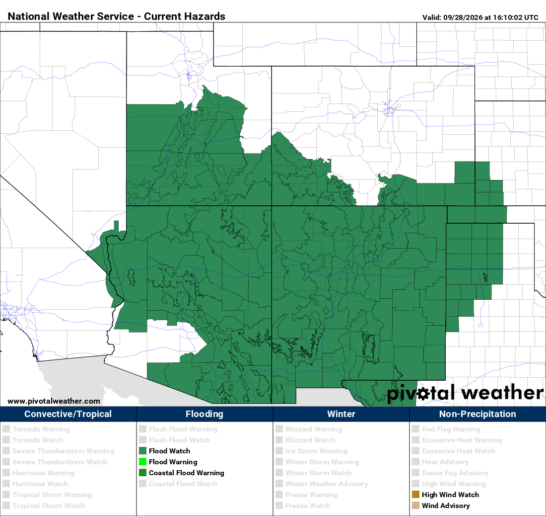
Emergency managers already have access to a wide range of information during a heavy rain event: forecasts, radar, Flood Watches, Flash Flood Warnings, stream gauges, and reports from the field. The challenge is rarely a lack of information. It's knowing what is happening at specific locations as rainfall unfolds, especially the roads, facilities, and neighborhoods they're responsible for.
The central distinction is simple. Forecasts describe what may happen. Real-time rainfall observations show what is happening at a specific location.
Localized rainfall data doesn't replace official National Weather Service (NWS) information. It adds another layer of situational awareness alongside it, helping emergency managers connect the broader regional picture to conditions on the ground.
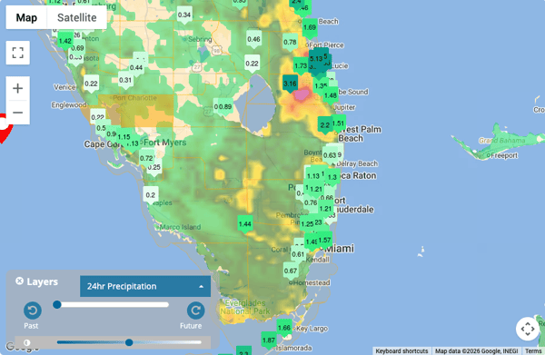
What Does Real-Time Rainfall Monitoring Tell Emergency Managers?
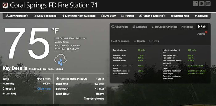
An on-site weather station measures rainfall where it falls, and reports it continuously. That makes several kinds of information available as a storm develops:
- Current rainfall rate, showing how intense the rain is right now
- Rainfall accumulation over different time periods, from the last few minutes to the last several days
- How quickly rainfall totals are increasing, which can reveal a storm intensifying or stalling
- Differences between locations, when more than one station is available
- Historical rainfall for comparison, putting the current event in context with past storms at the same site
Rainfall rate and rainfall accumulation answer different questions, and it helps to think about them separately:
| Measurement | Question it Answers |
| Current rate | How hard is it raining right now? |
| 15-minute or hourly accumulation | How much water has fallen recently? |
| 24-hour or 72-hour accumulation | How wet has the area already become? |
These questions map directly to the factors that drive flash flooding. Short-term intensity can overwhelm drainage quickly, while longer-term accumulation shows how saturated the ground and drainage systems may already be before the next round of rain arrives.
How Do Emergency Managers Use Rainfall Data Before Flash Flooding Develops?
The period before flooding begins, often while a Flood Watch is in effect, is when emergency managers have the most time to prepare. Real-time rainfall observations help them follow the event as it develops rather than waiting for impacts to appear. Rainfall data can help emergency managers:
- Track whether forecast rainfall is actually occurring. A forecast may call for heavy rain, but local observations show whether it's arriving, and when.
- Compare observed rainfall with expectations. Rain may be falling faster, slower, or in different places than forecast.
- Monitor locations where rainfall is concentrating. Heavy rain often falls unevenly, and some areas may receive far more than others.
- Identify when repeated storms are producing accumulating rainfall. Successive rounds of rain can build totals at one location even when each individual storm seems manageable.
- Maintain awareness of conditions before impacts become apparent. Rising totals at a known trouble spot can provide an additional reason to monitor that location more closely before water is visible on the road.
Rainfall data doesn't predict flooding. What it provides are observations that help emergency managers understand how the event is developing, so their decisions are based on what is actually happening, not only on what was expected.
How Does Rainfall Monitoring Support Flash Flood Response?
Once flooding is underway or imminent, the focus shifts from preparation to response. Decisions about road closures, public messaging, and where to send crews often need to be made quickly, and local rainfall observations can help inform them.
During a Flash Flood Warning
A Flash Flood Warning identifies the area where the threat is occurring, imminent, or otherwise poses an immediate threat, but conditions within that area can vary considerably. Rainfall observations can help show:
- Where heavy rain is continuing
- Which locations are receiving the highest rainfall rates
- Whether rainfall is increasing or decreasing
- How conditions differ across the warning area
Across Multiple Locations
With a network of stations, emergency managers can also identify:
- Areas receiving substantially more rain than others
- Differences between upstream and downstream locations, since rain falling upstream can affect areas downstream even after the rain there has stopped
- Whether a storm is concentrating rainfall in one part of a community
In every case, rainfall monitoring is additional information, not a replacement for official warnings. The NWS warning defines the threat. Local observations help emergency managers understand how that threat is playing out across their jurisdiction.
Why Rainfall Monitoring Is Especially Important During Training Storms
Training storms are a common setup for flash flooding, and they are one of the situations where local rainfall data can be particularly valuable. Training occurs when thunderstorms repeatedly develop and move over the same location, much like train cars passing over the same stretch of track.
When that happens:
- Storms can pass over the same location again and again, each adding to the total.
- Rainfall totals can increase rapidly, sometimes reaching several inches in just a few hours.
- Nearby areas can receive dramatically different amounts, since the training band may be only a few miles wide.
- A regional radar image doesn't necessarily tell you exactly how much rain has accumulated at a particular site. Radar estimates rainfall from above, while a rain gauge measures what actually reaches the ground at that location.
During training events, accumulated rainfall at a specific location is often more telling than any single storm. Watching totals climb at a station in the path of repeated storms can give emergency managers an early, concrete signal that an area is taking on more water than expected. For more on how intensity, duration, and storm movement combine to drive flooding, see How Much Rain Causes Flash Flooding.
How Can Emergency Managers Monitor Rainfall Across Multiple Locations?
A single weather station shows what's happening at one site. A network of stations shows how rainfall is distributed across an entire community, which is often what emergency managers need most during a flash flood event. That network can be especially useful in jurisdictions where rainfall, terrain, drainage, and flood risk vary significantly from one part of the community to another.
Building an effective local monitoring network typically involves:
- Strategically placed weather stations positioned to represent different parts of a jurisdiction, including areas with different terrain or drainage characteristics
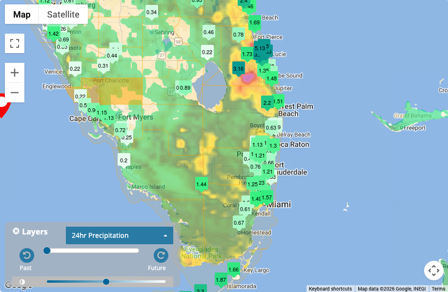
- Comparing rainfall across a city or county to see where the heaviest rain is falling and how totals differ from one area to the next
- Monitoring critical facilities such as hospitals, schools, emergency operations centers, and public works yards
- Monitoring flood-prone locations like low-water crossings, underpasses, and neighborhoods with a history of flooding
- Viewing multiple stations from a centralized platform so emergency managers can see the full picture at a glance instead of checking sites one by one
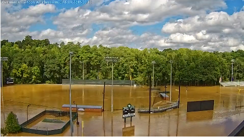
- Using cameras alongside rainfall measurements to confirm visually what the data suggests, such as water rising on a roadway
The value isn't just in measuring rain. It's in creating a localized monitoring network that reflects the specific geography, infrastructure, and vulnerabilities of the community an emergency manager is responsible for.
How Do Weather Alerts Complement Real-Time Rainfall Monitoring?
During a typical heavy rain event, information tends to build in layers. A forecast highlights the potential for heavy rain. A Flood Watch may follow. Local observations begin to show how much rain is actually falling. A Flash Flood Warning may be issued as the threat becomes more immediate, and monitoring continues as the event plays out. Events don't always follow that exact sequence, since flash flooding can develop quickly, with little warning, or outside a watch area, but the layers work best together.
Within that picture:
- Official NWS watches and warnings remain foundational. They reflect forecasters' assessment of the regional threat and provide an important part of the information used during flash flood response.
- Automated alerts can bring attention to changing local conditions. An alert can notify staff the moment rainfall at a specific station crosses a set level.
- Emergency managers can define rainfall thresholds relevant to their operations, such as a rate or accumulation known to cause problems at a particular underpass or creek crossing.
- Alerts reduce the need to continuously watch every station manually, which matters when staff are juggling many responsibilities during an event.
- Human interpretation and official information remain important. An alert is a prompt to look closer, not an automatic trigger for action.
Weatherstem can provide automated rainfall alerts based on thresholds emergency managers set, helping them stay aware of local conditions without monitoring every data feed by hand.
How Weatherstem Supports Real-Time Rainfall Monitoring
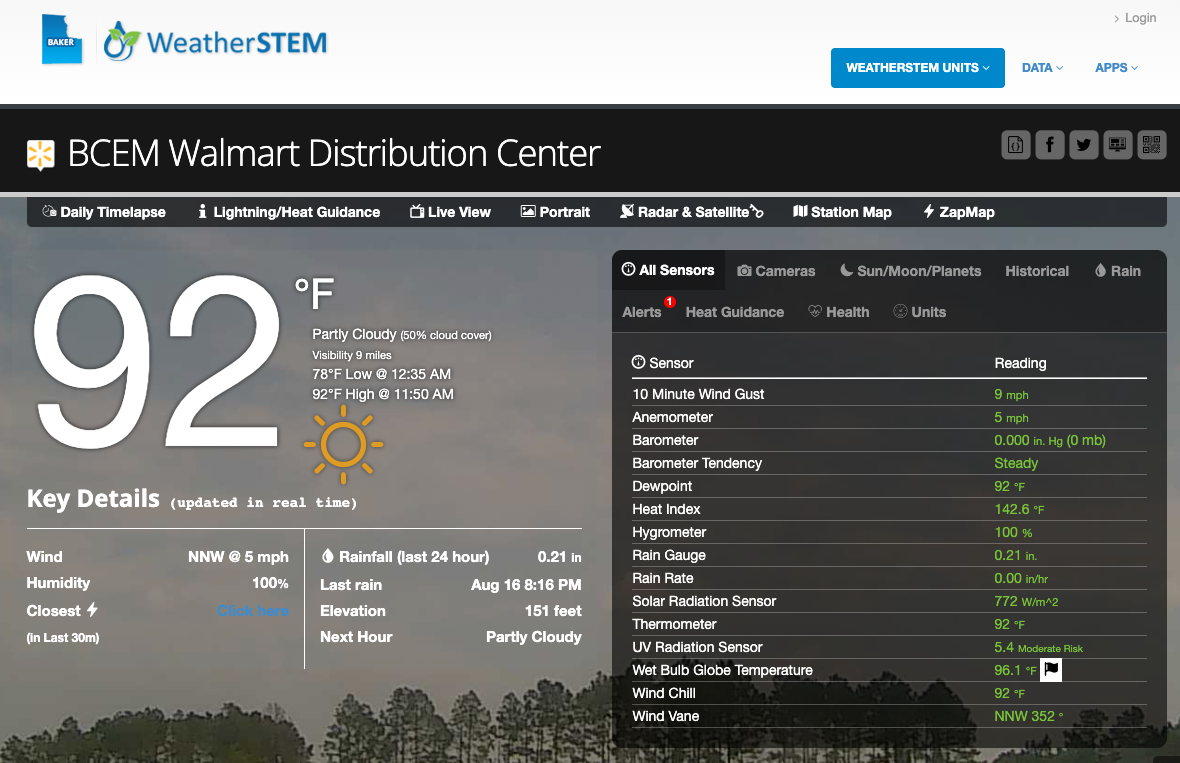
Weatherstem combines on-site weather stations and cameras with a software platform that gives emergency managers access to localized weather observations in real time. This provides another layer of information alongside forecasts, radar, watches, and warnings.
For flash flood monitoring, that includes:
- On-site weather stations that measure conditions at the locations that matter most
- Real-time rainfall measurements showing current rainfall rates as storms move through
- Multiple accumulation periods to track both short-term bursts and longer-term totals
- Networked stations that show how rainfall varies across a community
- Weather cameras that add visual context to the data
- Automated alerts that notify staff when rainfall crosses defined thresholds
- Historical data for comparing current conditions with past events and reviewing response afterward
- A centralized dashboard for viewing stations, cameras, and alerts in one place
Weatherstem does not replace official NWS warnings or flood forecasting. It provides localized observations that help emergency managers understand what is happening on the ground.
How Does Real-Time Rainfall Data Fit Into Flash Flood Monitoring?
Real-time rainfall monitoring doesn't tell an emergency manager by itself whether flooding will occur. It provides another piece of the operational picture, showing how much rain is falling, where it is falling, and how quickly accumulation is increasing.
Forecasts describe what may happen. Official watches and warnings define the threat. Local observations show how that threat is unfolding at the places that matter most. Used together, they give emergency managers a clearer, more complete view as a flash flood event develops.
What is real-time rainfall monitoring?
Real-time rainfall monitoring uses on-site weather stations to measure rainfall as it occurs, providing current rainfall rates and accumulated precipitation at specific locations.
How does real-time rainfall monitoring help emergency managers?
Real-time rainfall monitoring shows how much rain is falling, where rainfall is occurring, and how quickly accumulation is increasing. This gives emergency managers localized observations to consider alongside forecasts, radar, and NWS watches and warnings.
Can real-time rainfall data predict flash flooding?
No. Rainfall data alone cannot predict whether flooding will occur. It provides real-time observations that can help emergency managers understand how a rainfall event is developing and add local context to forecasts and official warnings.
Learn how Weatherstem can provide real-time, localized weather data for emergency management operations. Reach out here.

Weatherstem
Real-time weather monitoring built for compliance and life-safety decisions.
Professional hardware, dual lightning detection, automated alerts, and permanent data logging — installed and managed for you. Used by emergency management agencies, athletic programs, and government operations nationwide.
Book a Free Demo