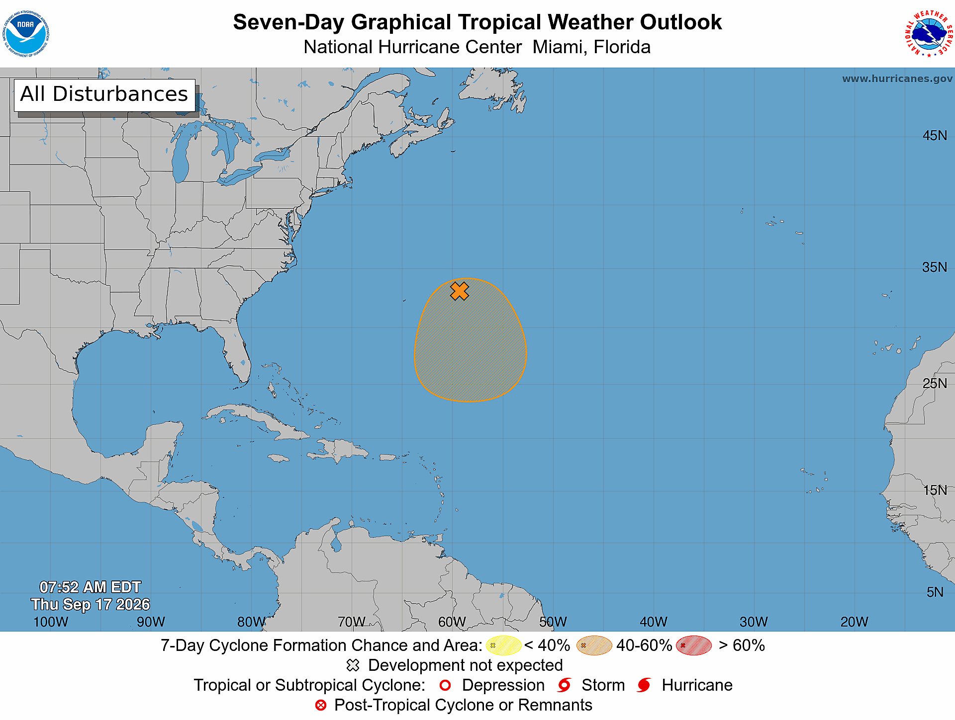
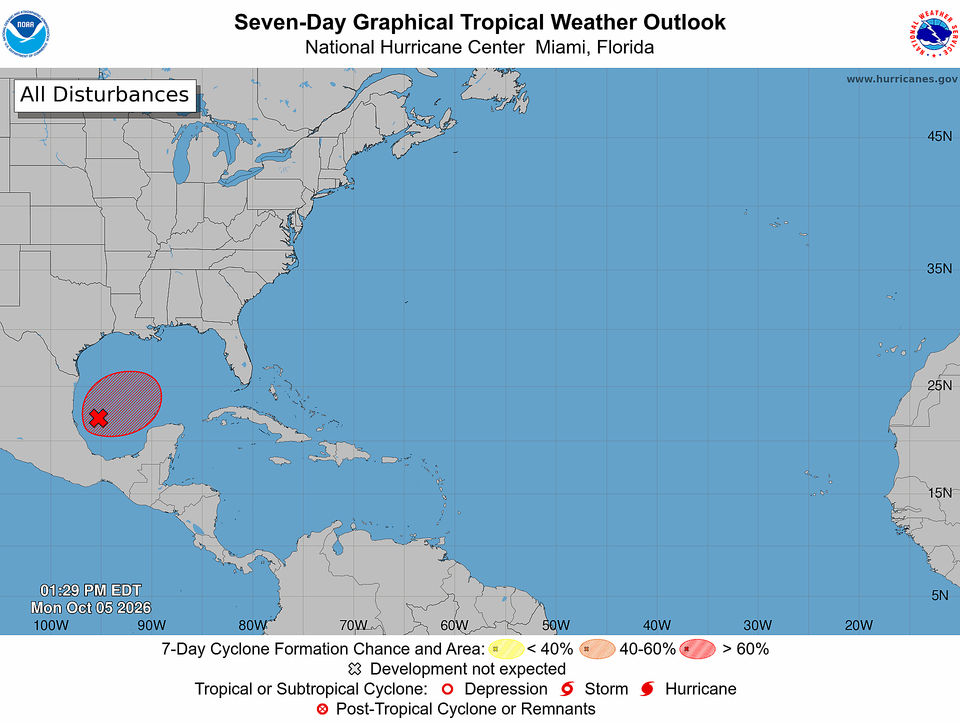
While the Atlantic basin has yet to produce a hurricane this season, it is far from over. The National Hurricane Center (NHC) is monitoring an area in the Gulf with a 70% chance of development over the next 7 days. There are still far more questions than answers with this system, but several factors are worth monitoring. Let’s break down the potential storm in today’s blog.
Factors for Development
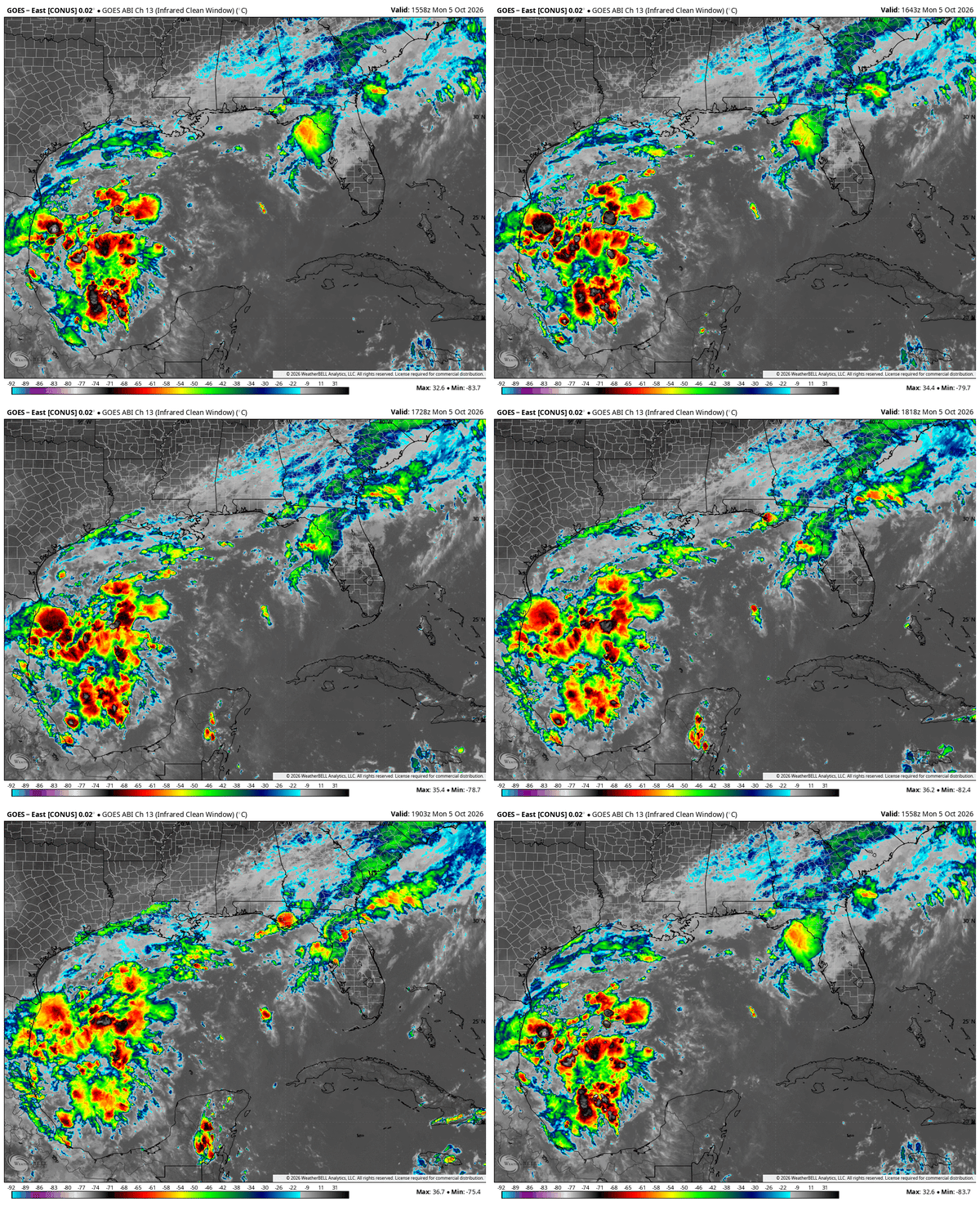
The system in the Gulf has been designated Invest 92L. It has developed along a frontal boundary in the Southwest Gulf, and convection associated with the system has increased throughout the day Monday, as you can see in the satellite loop below:
92L is currently over warm waters in the Gulf, with water temperatures 2-3° above average:
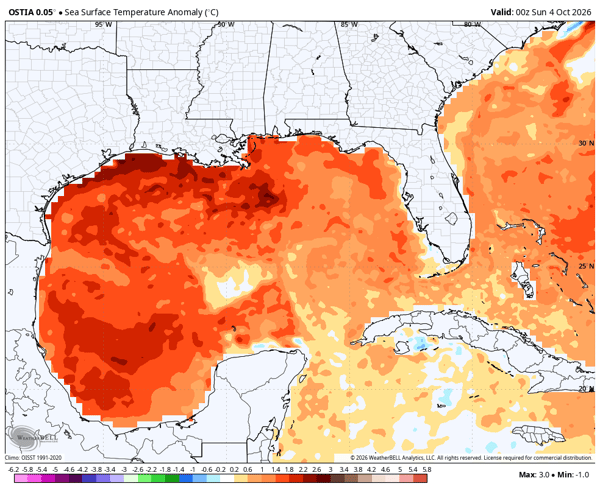
92L is expected to remain over the Southwest Gulf and Bay of Campeche for much of this week. The warm water in that area will provide a favorable factor for tropical development in the days ahead.
Wind shear over the Southwest Gulf and Bay of Campeche is currently relatively low, which could also support development. Once the system starts to move north later this week, it will start to encounter stronger shear across the Northern Gulf coast. The image below shows that strong wind shear Friday morning:
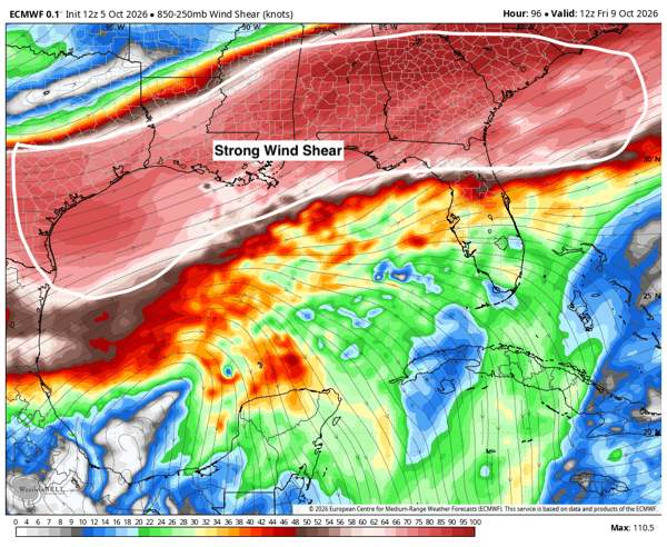
As we have discussed extensively this year since our first Atlantic Hurricane Season discussion, strong wind shear tends to disrupt tropical development and limit strengthening. Still, the system could develop into a tropical storm and will need to be monitored closely in the days ahead.
Where is 92L Headed?
While the question of intensity expected from 92L is still very much undetermined, the general path it is expected to take is north towards the northern Gulf Coast. Most models agree on this general path. Take the most traditional physics-based Euro model ensembles in the image below:
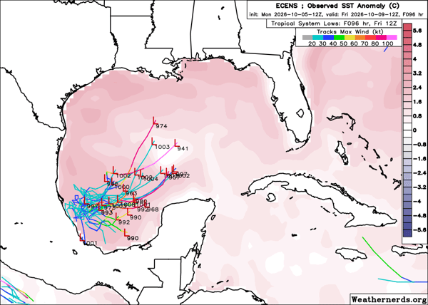
It shows the system meandering in the Southwest Gulf for a few days before eventually turning toward the north late this week. The image above is valid Friday morning. The physics-based GFS shows a similar solution:
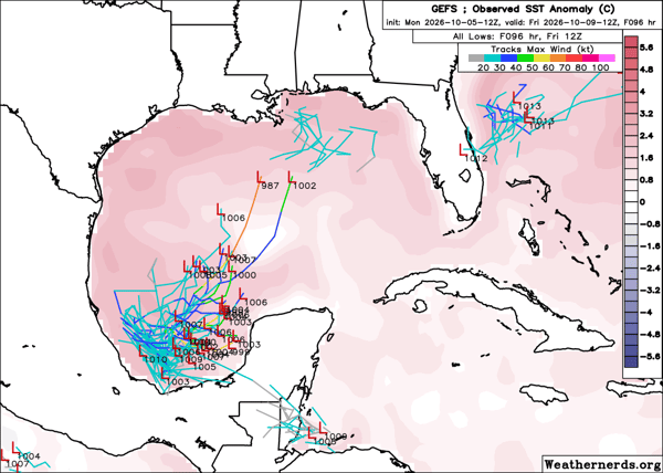
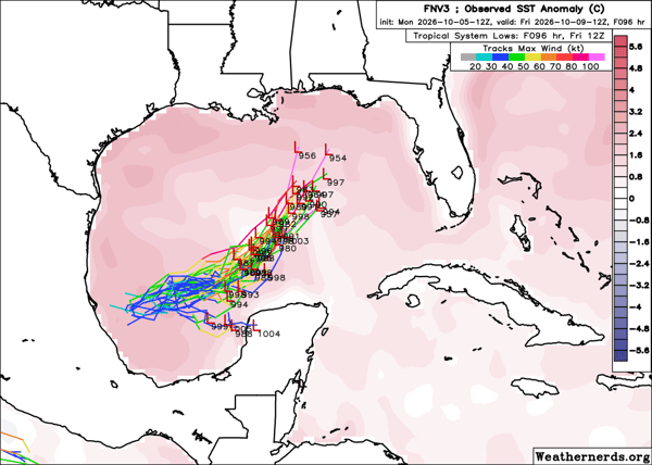
These traditional physics-based models also show a generally weak storm system with widespread heavy rain. The AI models, however, are showing a slightly different scenario with a stronger storm system moving farther east. A farther east path would keep 92L away from the stronger shear to the north and west. The Google DeepMind FNV3 model illustrates this possibility, with stronger solutions farther east:
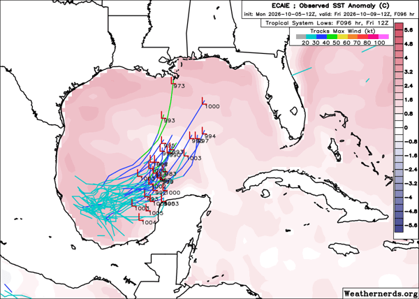
In addition, the Euro AI model is also leaning toward this solution as you can see in the image below:
One important caveat is that 92L has yet to develop into a well-defined tropical system, so forecasts will continue to evolve in the days ahead. Model guidance can also shift considerably as the system becomes better organized and observations provide a clearer picture of its structure and track.
Heavy Rain Likely Across Southeast This Weekend
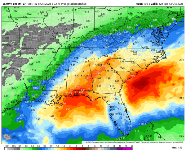
With more questions than answers right now for what will eventually happen with 92L, one signal consistently being forecast is for heavy rain across the Southeast this weekend. Below is the Euro ensemble for rain totals from Saturday, Oct 10 at 8 am to Tuesday, Oct 12 at 8am. It shows a solid signal for widespread rain across the Southeast:
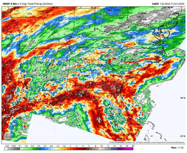
 This rainfall could lead to flooding concerns, particularly in areas that have already received significant rainfall this month. This includes the Florida Panhandle where some locations have already picked up nearly 5 inches of rain in October:
What to Watch This Week
There is still considerable uncertainty surrounding the eventual strength and track of 92L, and those details will become clearer as the system develops. The more consistent signal right now is for heavy rainfall across portions of the Southeast this weekend, particularly where soils are already saturated from recent rainfall.
We will continue to monitor 92L as it develops and provide updates as the forecast becomes more certain.
Could Invest 92L become a tropical storm?
Invest 92L could develop into a tropical storm as it moves across the Gulf, but there is still considerable uncertainty surrounding its eventual strength. The system has yet to become a well-defined tropical system, and forecast guidance continues to vary.
Where is Invest 92L headed?
Most forecast guidance currently shows Invest 92L moving generally north toward the northern Gulf Coast later this week. However, some AI models show a stronger system tracking farther east, so the exact track remains uncertain.
Will Invest 92L bring heavy rain to the Southeast?
Heavy rainfall is one of the more consistent signals in current forecast guidance. Portions of the Southeast could receive significant rainfall this weekend, particularly areas that have already experienced substantial rainfall in October.
What is Invest 92L?
An “Invest” is an area of weather that the National Hurricane Center is monitoring for potential tropical development.
Monitor Conditions in Real Time
Tropical systems can bring rapidly changing conditions to local communities. Weatherstem provides real-time, on-site weather monitoring that helps emergency management and operations teams maintain situational awareness as conditions evolve. Learn more about Weatherstem weather monitoring.
Weatherstem
Real-time weather monitoring for the organizations that can't afford to guess.
Professional hardware, live HD camera, automated alerts, and software — installed and managed for you. 900+ stations deployed nationwide across emergency management, athletics, and commercial operations.
Book a Free Demo