The Fourth of July holiday week is here, and the biggest weather story will be a widespread heat wave stretching from the Midwest to the East Coast. Hundreds of daily temperature records are expected to be challenged or broken as millions of people head outdoors for holiday celebrations. While the hottest weather will dominate the forecast, severe thunderstorms will also develop along the northern edge of the heat dome. Whether you're planning fireworks, travel, or outdoor events, this week's weather will require close attention, especially for emergency managers in charge of public safety during outdoor celebrations.
Heat Wave Spreads from the Midwest to the East Coast
The heat this week will start in the center of the country and spread to the East Coast. In fact, there are already multiple heat alerts in effect across the country:
 This heat will be the result of a strong upper-level ridge that will build from the Midwest to the Northeast. Below is an animation of the 500 mb heights from Monday afternoon to Friday morning:
This upper-level ridge causes hot temperatures by creating a dome of high pressure that traps and compresses air. As the air sinks, it compresses due to the increasing atmospheric pressure and heats up.
Record Potential
Starting Tuesday, over 160 record highs are possible through the Fourth of July, covering more geographic area each day:
Thursday and Friday have the highest record high potential, with over 40 locations forecasted to tie or break a record (the black squares below):

Locations that should easily break records include Boston, Washington, DC, Charlottesville, VA, and Portland, ME. On Friday, another three dozen or so records are likely:

Some of the same stations will have record highs again, including Washington, DC, Charlottesville, VA, and Boston with Philadelphia joining the list as well. For the actual holiday, record highs are still likely with Baltimore, Washington, DC, Raleigh, and Charlotte all expecting their hottest Fourth of July on record:

Dangerous Overnight Temperatures
The record warmth won't just be confined to the daytime. Overnight temperatures will also set records. In fact, there are over 400 record warm lows possible between now and Sunday morning:
These warm overnight lows are fueled by abundant moisture in the atmosphere, which prevents the air from cooling off at night. Warm overnight temperatures are particularly dangerous because they limit the body's ability to recover from daytime heat stress. This increases the risk of heat-related illness, especially for vulnerable populations and anyone without adequate cooling.
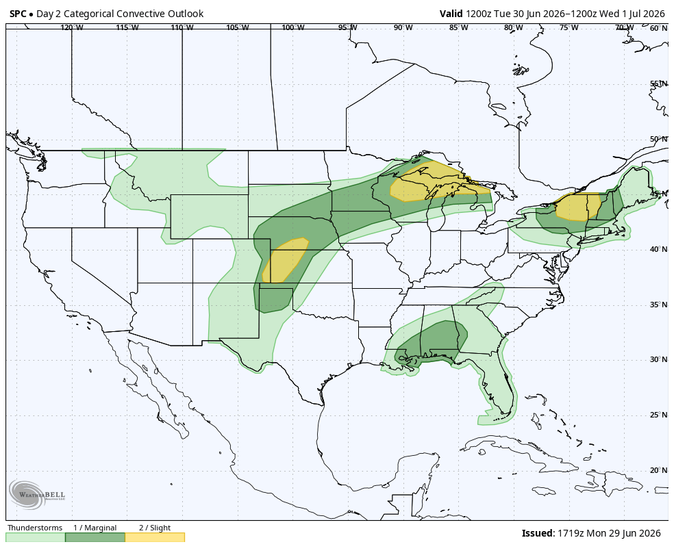
Storms Develop Around the Heat
Thunderstorms tend to ride along the northern edge of the heat dome where cooler air interacts with the hot, unstable air mass. Some of these storms could become severe with damaging winds, large hail, and localized flooding. On Tuesday, severe storms are likely across the Southwest, Upper Midwest, and Northeast:
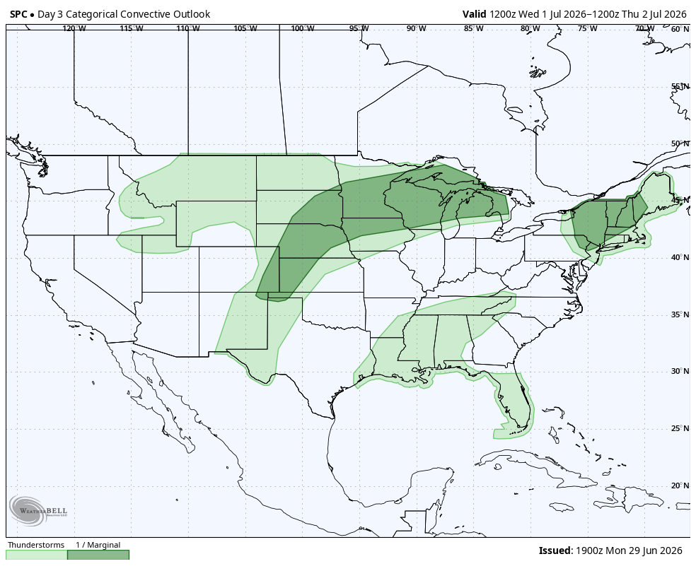
By Wednesday, similar locations are expected to receive severe thunderstorms:
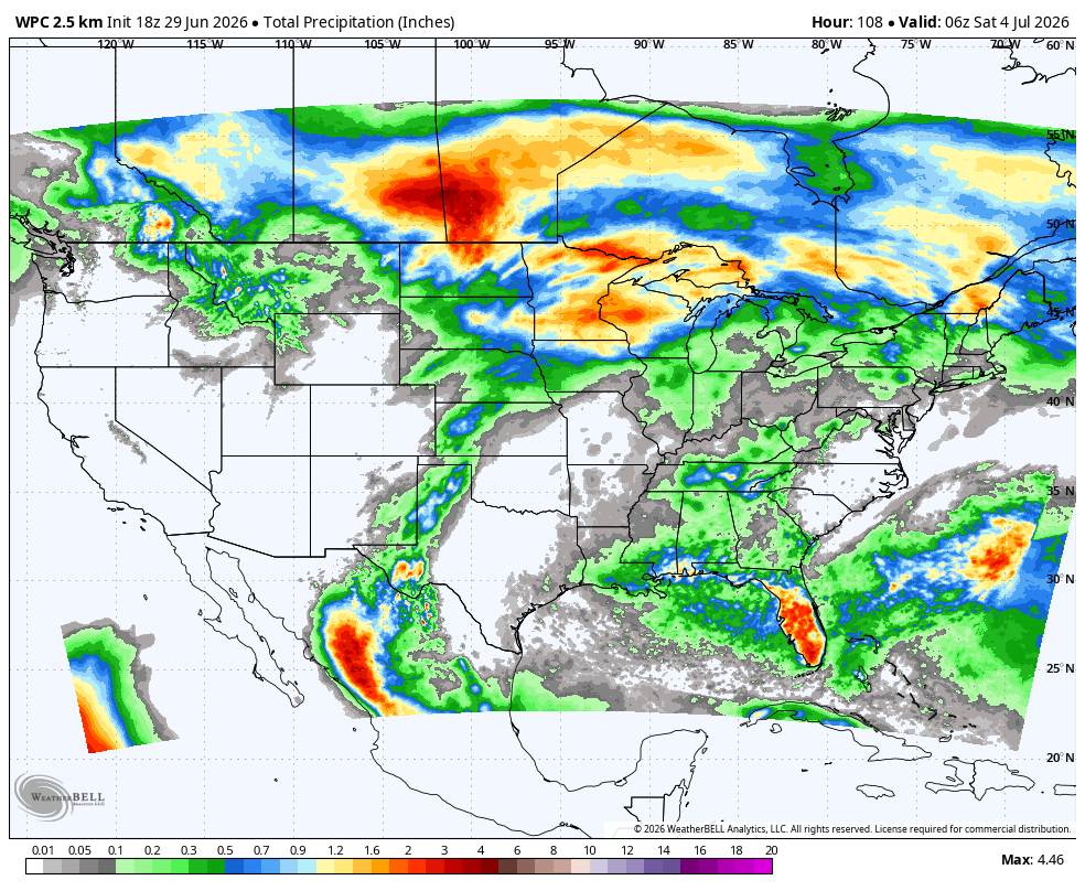
This pattern is evident in the rain forecast through late Friday night:
What Emergency Managers and the Public Need to Know
The combination of record heat and scattered severe thunderstorms will make weather one of the biggest concerns heading into the Fourth of July holiday. If you'll be spending time outdoors, plan activities during the cooler morning or evening hours, stay hydrated, and know the signs of heat-related illness. Event organizers and emergency managers should continue monitoring the latest forecasts, as both the heat and any developing thunderstorms could affect holiday celebrations across much of the eastern United States.
Need real-time weather monitoring for outdoor events or emergency operations? Weatherstem provides live weather observations, heat monitoring, lightning detection, and decision support tools to help organizations stay ahead of rapidly changing conditions. Learn more about how Weatherstem can support your operations: https://www.getweatherstem.com/contact-weatherstem
What is causing this Fourth of July heat wave?
A strong upper-level ridge, often called a heat dome, is allowing sinking air to warm while limiting cloud development. This pattern causes temperatures to climb well above average across much of the Midwest and eastern United States.
Why are warm overnight temperatures dangerous?
Warm overnight temperatures prevent the body from recovering after a hot day. When temperatures remain elevated overnight, the risk of heat-related illness increases, especially for older adults, young children, outdoor workers, and people without air conditioning.
Will this heat wave break temperature records?
Yes. Forecasts indicate hundreds of daily high temperature records and record warm overnight low temperatures could be tied or broken between Tuesday and the Fourth of July across the eastern United States.
Why do severe thunderstorms form around a heat dome?
Severe thunderstorms often develop along the northern edge of a heat dome where cooler air meets the hot, unstable air mass. This boundary can produce damaging winds, large hail, heavy rainfall, and localized flooding.
How can people stay safe during extreme heat?
Stay hydrated, take frequent breaks in air-conditioned spaces, avoid strenuous outdoor activity during the hottest part of the day, wear lightweight clothing, and check on vulnerable family members and neighbors. Event organizers should also monitor weather conditions throughout the holiday.
Weatherstem
Real-time weather monitoring for the organizations that can't afford to guess.
Professional hardware, live HD camera, automated alerts, and software — installed and managed for you. 900+ stations deployed nationwide across emergency management, athletics, and commercial operations.
Book a Free Demo

