Earlier this week, we wrote about the potential for a historic heat wave to impact much of the eastern United States ahead of and through the Fourth of July holiday weekend. Forecast confidence has increased, and as of the afternoon of July 2, many daily temperature records have already been broken. While the main story remains the dangerous heat, those hot and humid conditions will also help fuel thunderstorms, some of which could become severe through the holiday weekend. This operational update is intended for emergency managers and public safety officials preparing for one of the busiest weekends of the year for outdoor events.
Heat is Already Breaking Records
On Wednesday, July 1, numerous cities broke either daily record high temperatures, record warm low temperatures, or both. Syracuse, New York reached 96°F, setting a new daily high temperature record, while Cleveland climbed to 97°F. Overnight temperatures also remained unusually warm across much of the region, preventing many locations from cooling off and increasing the cumulative impacts of the prolonged heat wave.
 Record potential will continue into the holiday weekend and several locations could set their hottest July 4th on record. On Friday, the record potential reaches from the Carolinas to the Northeast (:

Baltimore could reach 104° which would break the old record by 2°. Records are likely in New York City, Philadelphia, and down to Charlotte, NC.
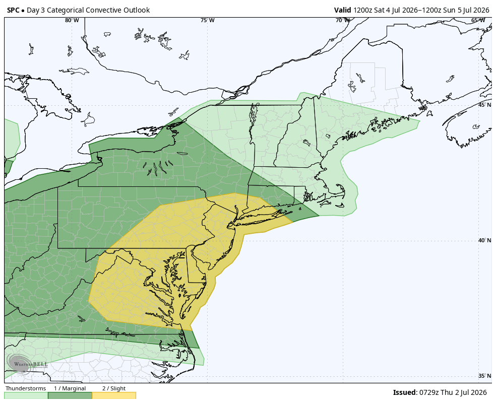
By the Fourth of July, the record potential shrinks a little but still covers a wide geographic region: 
With thousands of outdoor celebrations, parades, sporting events, and fireworks displays planned across the country for America's 250th birthday, heat safety should remain a primary planning consideration. Organizers should ensure adequate hydration, shaded areas, medical staffing, and cooling options are available for attendees, volunteers, and event personnel.
Record Heat to Fuel Dangerous Storms
Earlier this week, we also discussed how storms would develop around the heat. That forecast verified and you can see the evidence in the rainfall pattern the past 72 hours:
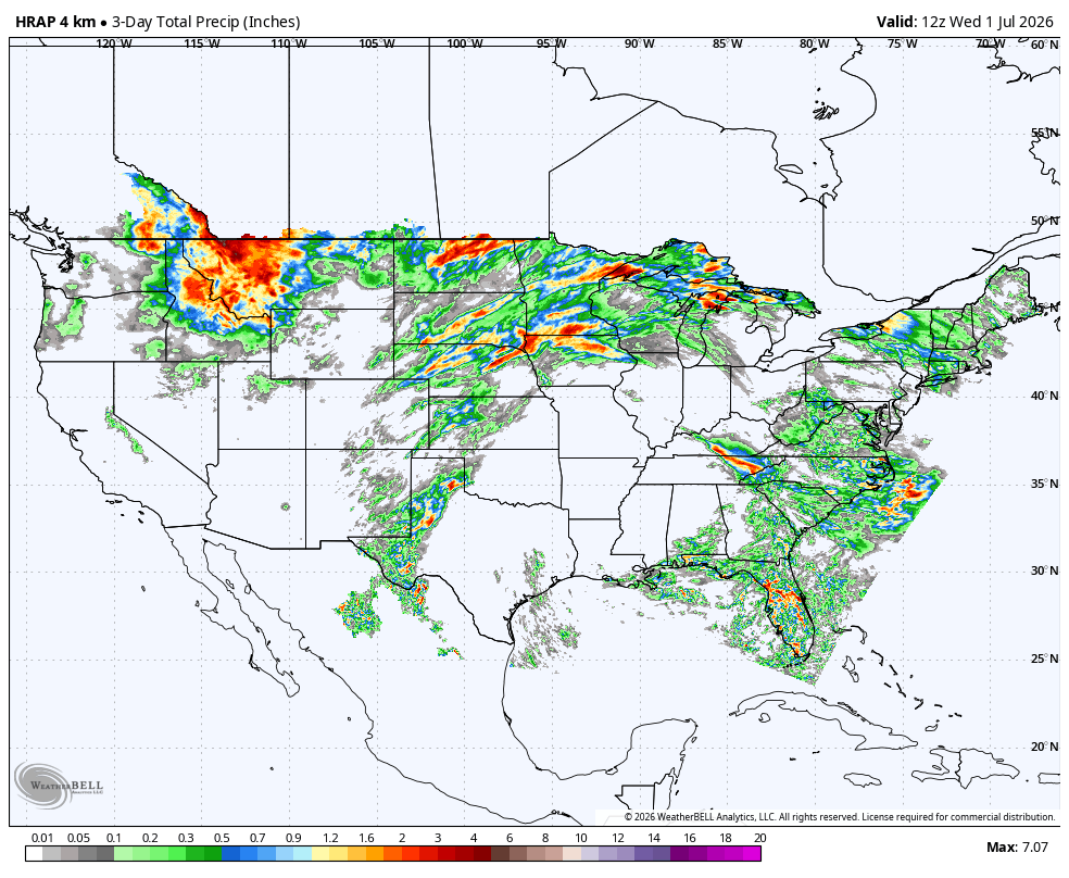
Storms have developed around the upper-level ridge responsible for the historic heat, bringing repeated rounds of heavy rain and severe weather to parts of the Northern Plains and Northeast. This pattern continues Thursday, with another round of overnight thunderstorms expected across portions of the Northern Plains.
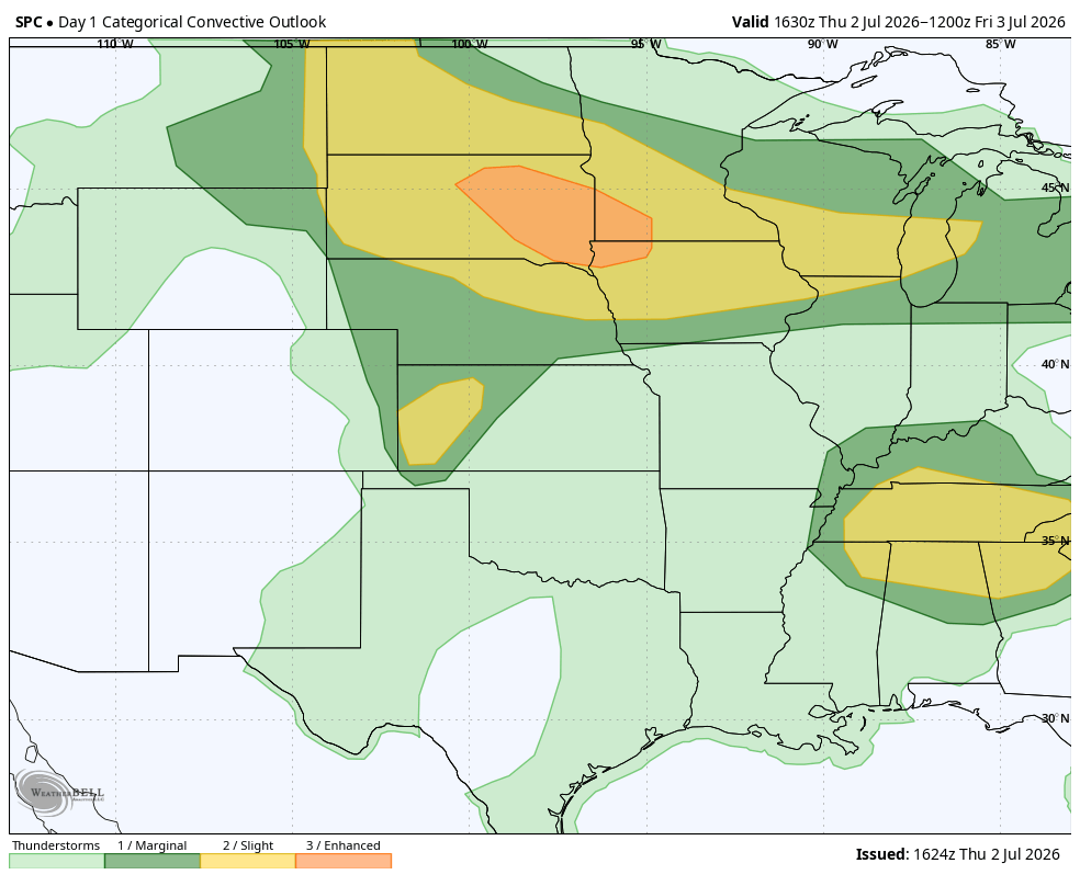
On Friday, as the dome of heat starts to break down some, the chance for severe weather extends from the Northern Plains, into the Great Lakes and Northeast:
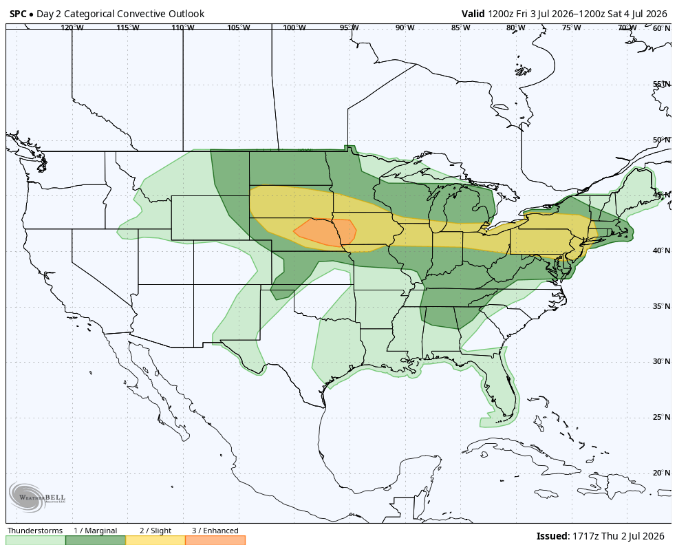
The severe weather for the Fourth of July holiday itself is fortunately confined to a much smaller area but it includes cities where some of the biggest celebrations are occurring:
Emergency managers and event organizers in New York, Philadelphia, and Washington, D.C., should closely monitor forecast updates as the holiday approaches. While it is still too early to determine exact timing, late afternoon into the evening is the most likely window for thunderstorm development. Any storms that form could produce dangerous cloud-to-ground lightning, damaging wind gusts, and brief periods of heavy rainfall that may require delaying or postponing fireworks displays and other outdoor activities. Having real-time weather monitoring and a clear sheltering plan will be essential.
What Emergency Managers Should Watch Through the Holiday Weekend
Storms often get the most attention but heat can be just as dangerous. Monitor heat alerts and overnight temperatures, especially for vulnerable populations. Wet Bulb Globe Temperature is an excellent measure of how heat impacts the body. Plans for opening cooling centers should also be considered and constant public messaging on hydration and the signs of heat illness are essential.
For storm potential, monitor radar and lightning trends to determine if its safe for outdoor events to continue. Have a plan in place for shelter, especially for outdoor events involving large gatherings. It takes significant time to evacuate a large crowd so plan accordingly.
Whether you're managing a Fourth of July celebration, supporting first responders, or coordinating emergency operations, access to real-time weather information is critical. Weatherstem provides the weather observations, lightning monitoring, cameras, and decision support tools emergency managers rely on to maintain situational awareness when every minute matters.
What areas are experiencing the record-breaking heat wave?
The most dangerous heat is affecting much of the eastern United States, with temperatures reaching record levels from the Carolinas through the Mid-Atlantic and Northeast. Some cities may experience their hottest Fourth of July on record.
Why is this heat wave so dangerous?
Extreme heat becomes more dangerous when it lasts several days and overnight temperatures remain unusually warm. Without cooler nighttime temperatures, people and infrastructure have less opportunity to recover from daytime heat.
How can thunderstorms develop during a heat wave?
Strong summer heat provides energy for thunderstorm development, especially around the edges of the upper-level ridge responsible for the heat. These storms can produce damaging winds, heavy rainfall, and dangerous cloud-to-ground lightning.
What should emergency managers monitor during Fourth of July events?
Emergency managers should monitor heat alerts, Wet Bulb Globe Temperature (WBGT), radar, lightning activity, and forecast updates. Having predetermined sheltering procedures and cooling plans can improve public safety during large outdoor events.
Why is WBGT important during outdoor events?
Wet Bulb Globe Temperature accounts for temperature, humidity, wind, and solar radiation to better estimate heat stress on the human body. It provides a more complete picture than air temperature alone when making decisions about outdoor activities.
Weatherstem
Real-time weather monitoring for the organizations that can't afford to guess.
Professional hardware, live HD camera, automated alerts, and software — installed and managed for you. 900+ stations deployed nationwide across emergency management, athletics, and commercial operations.
Book a Free Demo

