The main story across the Southeast this year has been the worsening drought. Since the beginning of the year, the percent of the region in extreme or exceptional drought (the two worst categories) has gone from just over 1% to 60%:
 Unfortunately for the holiday weekend but beneficially for the drought, heavy rain has plagued the region over the last few days. Since last Thursday, May 21, widespread rain of over 3" has fallen:
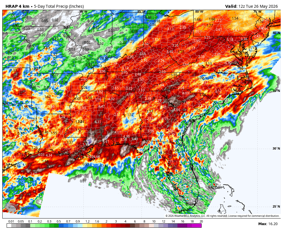
How Much Rain Ex Expected Across the Southeast This Week?
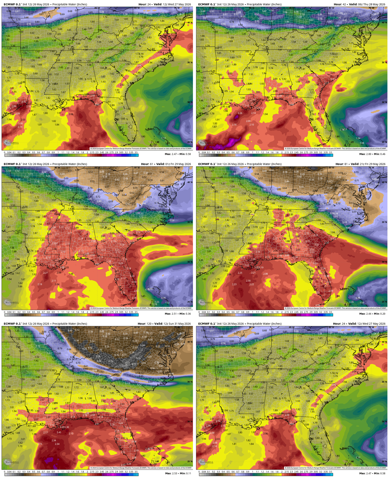
This wet pattern is going to continue through much of this week and into the weekend. Watch round after round of moisture get pulled up into the region. The below animation shows the precipitable water from Wednesday, May 27 through Tuesday June 2:
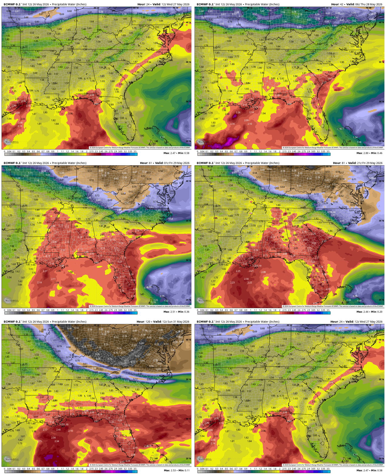 This is going to bring another 3" or more of rain around across a large chunk of the region. Below is the rain total expected through Tuesday, June 2nd:

Could Tropical Moisture Increase Rainfall in June?
As we get further into next week and the month of June, there is a non-zero chance that a weak tropical disturbance could develop and enhance the rainfall over the Southeast. Regardless of tropical development, rainfall will remain above average across the region for the first part of June. Below is the 7-day precipitation anomaly June 1 - June 8:

Low Severe Chances During the Typical Peak
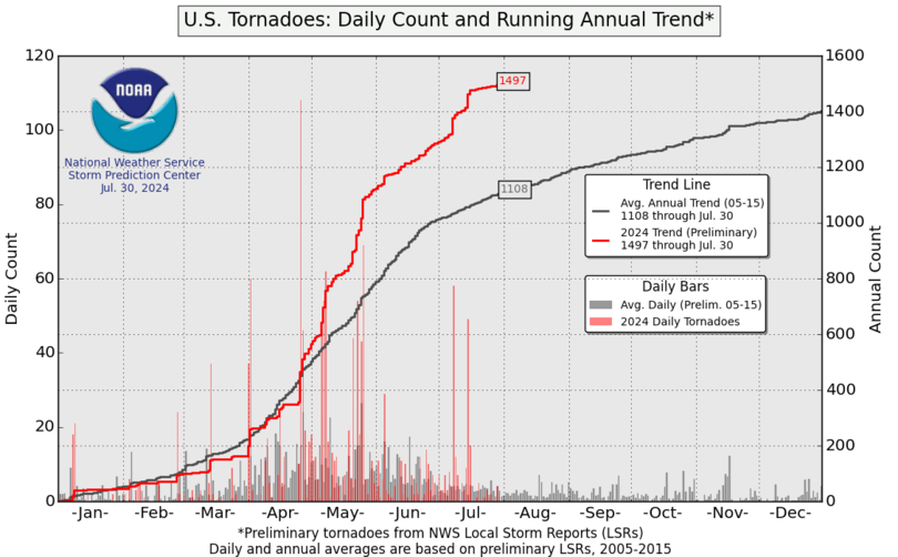
May is typically the busiest month for tornadoes but that pattern looks relatively quiet for the next couple of weeks. As it stands, the 2026 tornado count is right where we'd expect it to be this time of year:
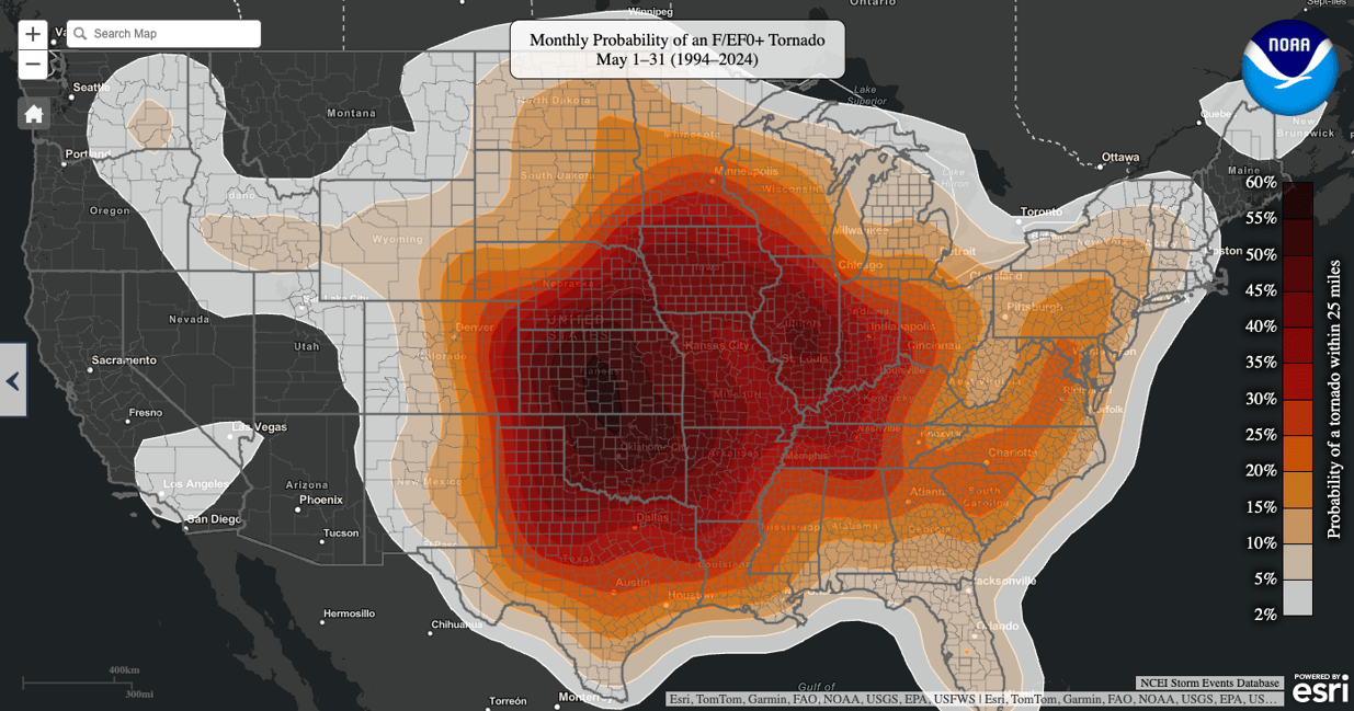
During the month of May, the Southern Plains are usually where tornado activity is most likely:
This May, not a single tornado has been reported in Oklahoma and the pattern the rest of the month doesn't look to change that fact. It's not just Oklahoma but much of the Plains that will see lower severe chances than typically expected this time of year as a ridge builds over the region:
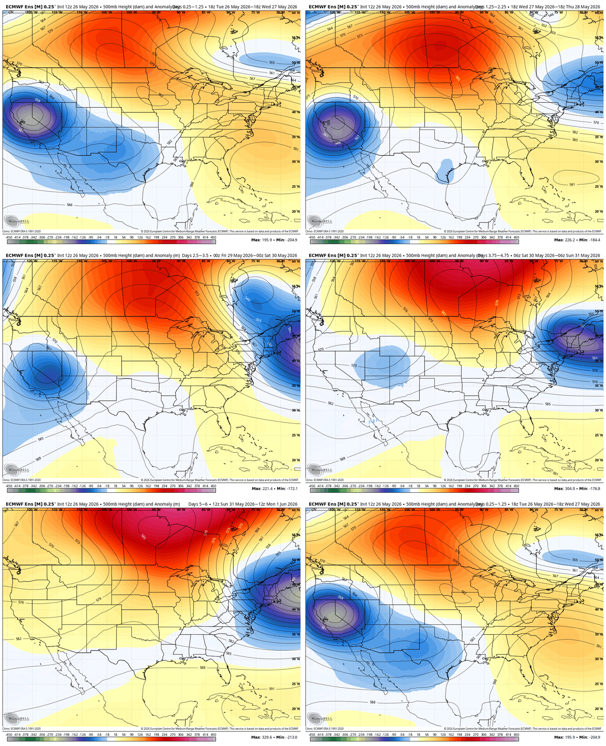 This lull in severe activity looks to last well into June. As rainfall and severe weather patterns shift across the Southeast, Weatherstem helps emergency managers and operations teams monitor real-time conditions, rainfall totals, lightning, and forecast trends from one platform: https://www.getweatherstem.com/contact-weatherstem
Why is the Southeast drought improving?
A persistent wet weather pattern has brought widespread heavy rainfall to the Southeast, with additional above-average precipitation expected into early June.
Could a tropical system develop in the Southeast in early June?
There is a low but non-zero chance that a weak tropical disturbance could develop and enhance rainfall across parts of the Southeast next week.
Why are tornado chances lower than normal this May?
A ridge building over the Plains is suppressing severe weather development, leading to unusually quiet tornado activity across Oklahoma and much of the central U.S.
Weatherstem
Real-time weather monitoring for the organizations that can't afford to guess.
Professional hardware, live HD camera, automated alerts, and software — installed and managed for you. 900+ stations deployed nationwide across emergency management, athletics, and commercial operations.
Book a Free Demo